
Vassilis Angelopoulos /
davin@ssl.berkeley.edu , ian.mann@ualberta.ca
nasa.gov/nssdc/ @nasa The NASA Space Science Data Coordinated Archive website is temporarily offline for maintenance. outage its the homepage for Themis igpp @ucla edu :: Measurements // NSSDC is part of the Solar System Exploration Data Services Office (SSEDSO) in the Solar System Exploration Division at NASA’s Goddard Space Flight Center … catalog.data.gov/dataset/national-space-science-data-center-master-catalog :: @NASA-GISS https://data.nasa.gov/dataset/national-space-science-data-center-master-catalog @whitehouse @blackgirlscode kim if the educators want to they can try this Near/Deep Space Monitoring Tool ScanNOW @la-county-isd if you look up every satelittle that beams in theres tons of f.o.i.a. @usdoj [1] data to harvest guilt free for teaching! Horizons is the system im using when im on @LACMTA METRO //
THEMIS Data Overview
The THEMIS probes provide field and plasma observations of the solar wind, magnetosheath, and magnetosphere. ReadMore + SwalesAerospace
![]() By NASA/KENNEDY SPACE CENTER, FLA. - https://mediaarchive.ksc.nasa.gov/#/Detail/305, Public Domain, Link
By NASA/KENNEDY SPACE CENTER, FLA. - https://mediaarchive.ksc.nasa.gov/#/Detail/305, Public Domain, Link
This site can’t be reached
data.nasa.gov took too long to respond.
Try:

Checking the connection
Checking the proxy and the firewall
Running Windows Network Diagnostics
ERR_TIMED_OUT
internal
Microsoft Windows [Version 10.0.18362.356]
(c) 2019 Microsoft Corporation. All rights reserved.

C:\Users\PAC>ipconfig /all

Windows IP Configuration

   Host Name . . . . . . . . . . . . : MPEIC21
Ethernet adapter Ethernet:

   Connection-specific DNS Suffix  . :
   Description . . . . . . . . . . . : Intel(R) Ethernet Connection (7) I219-LM
   Physical Address. . . . . . . . . : E4-54-E8-71-8F-EC
   DHCP Enabled. . . . . . . . . . . : No
   Autoconfiguration Enabled . . . . : Yes
   IPv4 Address. . . . . . . . . . . : 192.168.161.121(Preferred)
external
IP Details For: 205.154.246.88

Decimal:3449484888

Hostname:lib-03-subnet-88.rdns.cenic.net

ASN:2152

ISP:CENIC

Services:None detected

Country:United States

State/Region:California

City:Cypress

Latitude:33.8170 (33° 49′ 1.05″ N)

Longitude:-118.0373 (118° 2′ 14.25″ W)
 By Photo credit: NASA/Jerry Cannon - http://mediaarchive.ksc.nasa.gov/detail.cfm?mediaid=31350, Public Domain, Link
@jaxa gpm.nasa.gov is loading slow from longbeach public library @nasa-jpl took too long to respond.
This site can’t be reached
gpm.nasa.gov took too long to respond.
Try:

Checking the connection
Checking the proxy and the firewall
Running Windows Network Diagnostics
ERR_TIMED_OUT
Microsoft Windows [Version 10.0.18362.1256]
(c) 2019 Microsoft Corporation. All rights reserved.

C:\Users\PAC>ipconfig /all

Windows IP Configuration

   Host Name . . . . . . . . . . . . : MPEIC26
   Primary Dns Suffix  . . . . . . . : lbpa.local
   Node Type . . . . . . . . . . . . : Hybrid
   IP Routing Enabled. . . . . . . . : No
   WINS Proxy Enabled. . . . . . . . : No
   DNS Suffix Search List. . . . . . : lbpa.local

Ethernet adapter Ethernet:

   Connection-specific DNS Suffix  . :
   Description . . . . . . . . . . . : Intel(R) Ethernet Connection (7) I219-LM
   Physical Address. . . . . . . . . : E4-54-E8-71-87-47
   DHCP Enabled. . . . . . . . . . . : No
   Autoconfiguration Enabled . . . . : Yes
   IPv4 Address. . . . . . . . . . . : 192.168.161.126(Preferred)
   Subnet Mask . . . . . . . . . . . : 255.255.254.0
   Default Gateway . . . . . . . . . : 192.168.160.1
   DNS Servers . . . . . . . . . . . : 192.168.129.12
                                       192.168.128.12
   NetBIOS over Tcpip. . . . . . . . : Enabled

C:\Users\PAC>
Link @nasa-jpl @nasa-pds @nasa-openscapes IP Details For: 205.154.246.79
Decimal:3449484879
Hostname:lib-03-subnet-79.rdns.cenic.net
ASN:2152
ISP:CENIC
Services:None detected
Country:United States
State/Region:California
City:Cypress
Latitude:33.8170 (33° 49′ 1.05″ N)
Longitude:-118.0373 (118° 2′ 14.25″ W)
In 1997, NASA and the Japan Aerospace Exploration Agency (JAXA), launched the Tropical Rainfall Measuring Mission (TRMM) to learn more about the role of tropical rainfall in Earth’s water and energy cycles. Orbiting from 35° North to 35° South, the satellite carries the first space-based precipitation radar and a microwave imager designed to observe moderate to intense tropical rainfall. Wiki AGU EO

By NASA - https://science.nasa.gov/toolkits/spacecraft-icons (image link), Public Domain, Link
Registrar
get.gov
WHOIS Server
whois.nic.gov
https://lookup.icann.org/en/lookup @podaac @nasa-jpl @emit-sds @staeofcalifornia @blackgirlscode say @icann! LAtrice
Name: nasa.gov
Registry Domain ID: DF12B2D9A-GOV
Domain Status:
serverTransferProhibited

Nameservers:
a1-32.akam.net

a12-64.akam.net

a14-67.akam.net

a5-66.akam.net

a8-66.akam.net

a9-64.akam.net

Dates
Registry Expiration: 2026-07-31 14:55:32 UTC
Updated: 2025-09-07 18:35:13 UTC
Created: 1997-10-02 01:29:26 UTC
>EXACT< name search [SPACE sensitive]:
 NAME = artimis;
Continue [ <cr>=yes, n=no, ? ] :
*******************************************************************************
JPL/DASTCOM            Small-body Index Search Results     2026-Jan-22 11:18:40
 Comet AND asteroid index search:
   NAME = artimis;
 Matching small-bodies:
    No matches found.
*******************************************************************************
 Select ... [F]tp, [M]ail, [R]edisplay, ?, <cr>: artemis
*******************************************************************************
 Multiple major-bodies match string "ARTEMIS*"
  ID#      Name                               Designation  IAU/aliases/other
  -------  ---------------------------------- -----------  -------------------
     -192  THEMIS-B (spacecraft)              2007-004B    ARTEMIS-P1
     -193  THEMIS-C (spacecraft)              2007-004C    ARTEMIS-P2
    -1023  Artemis I (spacecraft)             2022-156A    Orion EM-1

   Number of matches =  3. Use ID# to make unique selection.
*******************************************************************************
 Select ... [F]tp, [M]ail, [R]edisplay, ?, <cr>: -1023
*******************************************************************************
 Revised: Dec 10, 2022        Artemis I / Spacecraft (Earth)              -1023
                              https://www.nasa.gov/artemis-1
 BACKGROUND:
  NASA's 26-day unmanned Artemis I mission was a test of integrated systems to:
   - launch Orion atop the SLS rocket
   - operate the spacecraft in a deep space environment
   - orbit the Moon in a distant retrograde orbit before returning to Earth
   - test Orion's heat shield at 30,000 km/hr (2760 deg. C), and
   - recover the crew module after reentry, descent, and splashdown
 MAJOR EVENTS:
  Launched November 16 @ 06:47:44 UTC from pad 39B at the Kennedy Space Center.
  Relative timings below may or may not be be shifted slightly due to launch
  being delayed 43 minutes.
  launch+00h 18m 09s - Orion deploys solar arrays in Earth orbit
        +00h 52m 56s - Perigee raise maneuver (22 second burn)
        +01h 29m 27s - Trans-lunar injection burn (18m burn)
        +01h 57m 36s - Orion/ICPS separation
@TheSpaceDevs @nasa-pds @emit-sds . . .
Artemis I Weather Criteria
@cityoflosangeles @la-county-isd you guys should know about these things, then theres places we can team to keep los angeles safe Mrs Solis @bloomberg @foxnews
https://web.archive.org/web/20220430125134/https://www.nasa.gov/artemis-1 Artemis1 The Link Points to nasa.gov/images/ January 26 is the earliest snapshot revealing the artemis 1 mission log being vandalized @whitehouse i need mrs bass at somepoint to help me with my family, somone trying to kill me! This is from around the fires
Loading...

https://www.nasa.gov/artemis-1/ |
13:38:09 January 26, 2025

Got an HTTP 301 response at crawl time

Redirecting to...

https://www.nasa.gov/images/
Loading...

https://www.nasa.gov/artemis-1/ |
18:07:54 February 04, 2025

Got an HTTP 301 response at crawl time

Redirecting to...

https://www.nasa.gov/images/
Loading...

https://www.nasa.gov/artemis-1/ |
21:23:53 July 23, 2024

Got an HTTP 302 response at crawl time

Redirecting to...

https://www.nasa.gov/mission/artemis-i/
https://web.archive.org/web/20240723212353/https://www.nasa.gov/mission/artemis-i/
https://web.archive.org/web/20240723212353/https://www.nasa.gov/mission/artemis-i/ @nasa @whitehouse @dhs-gov
Stereo
@nasa-jpl @blackgirlscode its back up but with a warning @whitehouse
We expect the stereo.gsfc.nasa.gov web site to be decommissioned early in 2026. With a few exceptions for out-of-date material, all resources have been copied to https://stereo-ssc.nascom.nasa.gov/ . Please change any bookmarks or automatic downloads you may have set up. https://stereo.gsfc.nasa.gov/ @JHUAPL @CityOflosangeles KarenBass Kamlager Dove @la-county-isd
@usgs @usnavy @nasa-jpl the site for stereo is not responding! Im using the general population lab at BillieJeanKingLibrary @Nasa-develop hi @blackgirlscode @nasa-giss @emit-sds @podaac - Rashard
Deep Space Climate ObserVatoRy (DSCOVR)
SPace Weather
ITs not serving results from common sense check box clicking… i spoke about it on MyChangelog a few months back just parse it. @nasa-jpl @noaa @nasa @weather-gov @whitehouse @thespacedevs @blueorigin
This is how its supposed to look
Cassini Raw Images
link - solarsystem.nasa.gov
@nasa-jpl @nasa-pds @nasa @nasa-develop i cannot fetch zipfiles @stanford @UniversityofFlorida @blackgirlscode Latrice / Normani @howard-university-web-services :::::::: @la-county-isd @cityoflosangeles alot of our disruption is coming from the tourism industry . . . SZA - Saturn : WATCH : Lyrics soundcloud she dont mean any harm, but since her lyrics cover a lot of emotional things the song is a good barometer that she attracted some hackers . . . @usgs
ERROR: Raw image download request failed. Please try again or contact administrator.
JPL Horizons, version 4.98d
Type '?' for brief help, '?!' for details,
'-' for previous prompt, 'x' to exit
System news updated November 13, 2025

Horizons> saturn
*******************************************************************************
 Multiple major-bodies match string "SATURN*"
*******************************************************************************
 Revised: April 12, 2021         Saturn Barycenter                            6

 Dynamical point:
 ---------------
 The location of the center-of-mass of the Saturn system.
— as of 2:14 i was able to download all the raw images, however, getting them onto archive is a chore resume uploading …. Error 5 something or 4* @nasa-pds
@blackgirlscode GM if any of you are doing hours for community service the cassini site has data flow issues. I think its me. I was looking to animate an image of the week. Its usually a great shot and the user is already working the issue and i need to get some files in… But they are missing \ @nasa-pds @nasa-jpl im seeking august13 2013 - aug21 for a transition of the sun shining through the rings @nasa @TheSpaceDevs @BlueOrigin @cityoflosangeles @stateofcalifornia @LA-County-iSd
Cassini Raw Images
This gallery contains the full record of the Cassini spacecraft’s raw images taken from Feb. 20, 2004 to Cassini’s end of mission on Sept. 15, 2017. The archive will remain available to all as a historical record. @whitehouse
ERROR: Raw image download request failed. Please try again or contact administrator.
` missing `
File name: N00215278.jpg
Taken: Aug. 13, 2013 11:19 PM
Received: Aug. 14, 2013 8:32 AM

The camera was pointing toward SATURN, and the image was taken using the CL1 and CL2 filters. This image has not been validated or calibrated. A validated/calibrated image will be archived with the NASA Planetary Data System.

Image Credit: NASA/JPL-Caltech/Space Science Institute
404
The URL you were looking for cannot be found.
https://www.earthdata.nasa.gov/news/blog/earthaccess-earth-science-data-simplifiedl
@ornldaac i took the l out and opened a PullRequest @la-county-isd MayorBass @cityOflosAngeles Mrs Mitchell @emit-sds @nasa-openscapes @nasa-develop https://github.com/ornldaac/airborne/pull/1/commits/7ac967dea5686a7e582c3b39dc09f34fea923681 @Blackgirlscode AzioShortyLatrice ? thats a pizza place @podaac back east
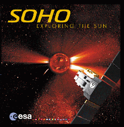
SOHO Realtime Image Viewer (Linux) @blackgirlscode you might find it on archive.org @cityoflosangeles
Kicker applet for viewing realtime images of the Sun provided by the SOHO satellite and several other sources ( Download and Information) Link
@nasa-pds @kde Not Found (ocs-web-5) https://www.kde-apps.org/content/show.php?content=31311 @nasa-jpl @podacc @hirise @asu @esa
@nasa-pds something is wrong with barbara thompsons website. ImageMagick may be broken. My videos are not playing either that i compile on my CloudMobile in @termux @blackgirlscode so @ffmpeg wont spit out a good file atm https://isd.lacounty.gov/ @la-county-isd
Current // HelioPhysics @nasa-jpl
Current // HelioPhysics @nasa-jpl https://sdo.gsfc.nasa.gov/data/

@github i would like to be guided to more info on stale connections
@LACountyDPH @CityOfLosAngeles @DataDesk @NAsa-jpl @la-county-isd Holly Mitchell / Karen Bass
I got a computer use card at the long beach library, thanks for any help you all @nasa-jpl @blackgirlscode latrice / normani
Long Beach 205.154.246.79
active
Your current session
Seen in US
Long Beach 205.154.246.88
stale
Last accessed on Dec 31, 2025
Seen in US
Long Beach 205.154.246.79
stale
Last accessed on Dec 31, 2025
Seen in US
Long Beach 205.154.246.79
stale
Last accessed on Dec 30, 2025
Seen in US
@nasa-jpl @podaac @nasa Worldview is tossing 500’s from Long Beach Public if i try to generate an image file for a map @nasa-pds @blackgirlscode @howard-university-web-services
https://wvs.earthdata.nasa.gov/api/v1/snapshot?REQUEST=GetSnapshot&TIME=2025-12-20T00:00:00Z&BBOX=33.938,-118.7662,34.3079,-118.0098&CRS=EPSG:4326&LAYERS=OSM_Land_Water_Map,HLS_S30_Nadir_BRDF_Adjusted_Reflectance,OPERA_L3_DIST-ALERT-HLS_Color_Index%28disabled=0%29,Coastlines_15m&WRAP=x,none,none,x&FORMAT=image/png&WIDTH=2754&HEIGHT=1347&colormaps=,,OPERA_Vegetation_Disturbance_Status,&OPACITIES=,,,0.67&MARKER=-118.2433,34.0522&ts=1767224636395
Internal Server Error
The server encountered an internal error and was unable to complete your request. Either the server is overloaded or there is an error in the application.
@meta im going to clean up my phone, possibly get an sdcard from best buy and ssee if i can access @WhatsApp
@nasa-jpl i needed to get my @redhat training certificate out of my facebook account for that girl from howard Latrice Fitzpatrick she very business oriented and if im not supposed to be romantic and i do that style of communication with her, i could miss out on money and possibly access to my daughter! She dropped me off at Dance411 [1] so the image of what i am im not and im terrified! so ill play with this after i go to hollywood best buy for a sub$10 micro sd NAsa Earthdata work is filling up disk space, then theres the hunt for wifi that will actually allow me to upload @cityoflosangeles @stateofcalifornia @blackgirlscode
@facebookresearch i have been working out of Billy Jean in Long Beach and its like Denver and Seattle and i get comprimised a lot.. I know Shane from Web Dot Com… So i ddont know if he polluted you guys with Dance411 gossip, because the soundcloud boys would drop in after the normie hampster wheel sessions were over and they rockit out playboy style in celebration of thier hollywood blvd accomplishments and they have ties to Paul Mitchell in BeverlyHills [1]
https://www.facebook.com/checkpoint/1501092823525282/?next=https%3A%2F%2Fwww.facebook.com%2F#
Enter mobile number
We’ll send a code via WhatsApp or SMS to confirm the mobile number you give us.
Country code
United States of America (+1)
Mobile number
Adding your number here lets Facebook use it to help you log in, protect our community, accurately count people who use our services, and assist you in accessing Facebook and opt-in programs, but not for purposes such as suggesting friends or providing ads. Only you will see this number on your profile. If the number added here is provided elsewhere across Facebook Company Products, it may be used for other purposes including suggesting friends or providing ads.
@GitHub Stale and ActiveSessions @blackgirlscode im revoking all for security im scared!
Long Beach 205.154.246.88
active
Your current session
Seen in US
Long Beach 205.154.246.79
stale
Last accessed on Dec 09, 2025
Seen in US
Long Beach 205.154.246.88
active
Your current session
Seen in US
California 107.77.229.135
active
Last accessed on Dec 10, 2025
Seen in US
Long Beach 205.154.246.79
stale
Last accessed on Dec 04, 2025
Seen in US
Long Beach 205.154.246.79
active
Your current session
Seen in US
Long Beach 205.154.246.88
active
Last accessed on Dec 09, 2025
Seen in US
Long Beach 205.154.246.88
active
Last accessed on Dec 09, 2025
Seen in US
Long Beach 205.154.246.88
active
Last accessed on Dec 09, 2025
Seen in US
Long Beach 205.154.246.79
stale
Last accessed on Dec 06, 2025
Seen in US
Long Beach 205.154.246.79
stale
Last accessed on Dec 04, 2025
Seen in US
Voyager 1 Red Spot Movie
link
@nasa-pds
citations are broken on some images @nasa-jpl @emit-sds @nasa @blackgirlscode
Source http://solarsystem.nasa.gov/multimedia/display.cfm?IM_ID=2149 resolves to https://solarsystem.nasa.gov/multimedia/display/?IM_ID=2149
Page not found
The page you requested either doesn’t exist anymore, or was moved.
You can try searching for the topic, or follow the links below.
DATA ALERT: Anomaly affecting the OPERA DSWx-S1 product: OPERA has discovered a processing error affecting DSWx-S1 data products generated from May 2025 onwards. This error is causing Sentinel-1A (S1A) and Sentinel-1C (S1C) data to be incorrectly mixed into a single product. This issue is currently under investigation by the OPERA team. As a precaution, the OPERA team has temporarily stopped the production of DSWx-S1 while they resolve this matter. We will provide more information as soon as it becomes available. We apologize for any inconvenience this may cause.https://podaac.jpl.nasa.gov/
@noaagov @commercegov @nasa-jpl @NASA-DEVELOP I left a comment a few days after discovrEpic stopped sending pics and the magnet 🧲 data got interrupted… looking for correlation @blackgirlscode @cityoflosangeles @stateofcalifornia
@NASA Continuity of Appropriations Plan PDF :: @whitehouse @NASA Appropriations and Authorizations: At a Glance @FoxNews @blackgirlscode @usnavy @Nasa-jpl @whitehouse @cityoflosangeles @stateofcalifornia @newshour
<object>:
The External Object element
@w3c
The
<object
  data="https://eyes.nasa.gov/curiosity/"
  type="text/html"
  width="250"
  height="200"></object>

<object
data="https://mars.nasa.gov/files/mep/Mars_Exploration_Program_Future_Plan.pdf"
  type="application/pdf"
  width="250"
  height="200"></object>
@blackgirlscode @cityoflosangeles @nasa-jpl @emit-sds
droughtMonitor is running on fumes primoMix
@nasa-jpl @nasa-pds
issue front end has not updated since july 2015
@nasa-jpl its a Langley Product @nasa-develop
this is the last image, i will look for data stores my next sech
The Human Footprint
Increased human population often leads to greater influence on the environment and sharper declines in species and ecosystems. readmore about the datasets affected
https://rashardmro.tumblr.com/post/786199636241219584/pilot-planetary-image-locator-tool-usgs

Mars Reconnaissance Orbiter : Mission Objectives NASA’s Mars Reconnaissance Orbiter searches for evidence that water persisted on the surface of Mars for a long period of time. ReadMore
@LACMTA @EMIT-SDS @CITYOFLOSANGELES @blackgirlscode @nasa @nasa-jpl @dhs-gov firms is blocked on the Metro @datadesk
~/.../mame2003/namco $ nc -t horizons.jpl.nasa.gov 6775
��������!!!!!!!!!!!!!!!!!!!!!!!!!!!!!!!!!!!!!!!!!!!!!!!!!!!!!!!!!!!!
 Unable to negotiate connection within 2 seconds. Defaults:

 TERM= vt102, ROWS= 9999, COLUMNS= 9999, ECHO on, FULL-DUPLEX

 Your terminal, command-line, telnet, or connection program
 may not be compliant with RFC 854 and RFC 1073 standards:
           http://tools.ietf.org/rfc/rfc854.txt
           http://tools.ietf.org/rfc/rfc1073.txt
 Using a different program to connect may solve the problem.                                                  -OR -                                                      The network may be slow and need > 2 seconds (try again).
!!!!!!!!!!!!!!!!!!!!!!!!!!!!!!!!!!!!!!!!!!!!!!!!!!!!!!!!!!!!
                              ======================================================================              |                     Jet Propulsion Laboratory                      |              |                                                                    |              |                  * * *    W A R N I N G   * * *                    |
  |                                                                    |              |                          Property of the                           |
  |                      UNITED STATES GOVERNMENT                      |              |                                                                    |              |    This computer is funded by the United States Government and     |
  | operated by the California Institute of Technology in support of   |              | ongoing U.S. Government programs and activities.  If                                                                                         ___    _____     ___                                                               /_ /|  /____/ \  /_ /|       Horizons On-line Ephemeris System v4.98d               | | | |  __ \ /| | | |                              JPL Horizons, version 4.98d Type '?' for brief help, '?!' for details,              '-' for previous prompt, 'x' to exit                    System news updated October 31, 2025                                                Horizons> cassini           cassini                     *******************************************************************************
 Multiple major-bodies match string "CASSINI*"
  ID#      Name                               Designation  IAU/aliases/other          -------  ---------------------------------- -----------  -------------------            -82  Cassini (spacecraft)               1997-061A
     -150  Cassini Huygens (spacecraft)       1997-061C
   Number of matches =  2. Use ID# to make unique selection.
*******************************************************************************
 Select ... [F]tp, [M]ail, [R]edisplay, ?, <cr>: Ncat: Software caused connection abort.                        ~/.../mame2003/namco $ nc -t horizons.jpl.nasa.gov 6775 Ncat: TIMEOUT.
~/.../mame2003/namco $ python                           Python 3.12.12 (main, Oct 18 2025, 05:45:20) [Clang 19.0.1 (https://android.googlesource.com/toolchain/llvm-project 97a699bf4 on linux
Type "help", "copyright", "credits" or "license" for more information.
>>> 5 + 30 * 20             605                         >>> 5 + 30 * 20
605                         >>> quit()
~/.../mame2003/namco $ nc -t horizons.jpl.nasa.gov 6775 ��������!!!!!!!!!!!!!!!!!!!!!!!!!!!!!!!!!!!!!!!!!!!!!!!!!!!!!!!!!!!!                 Unable to negotiate connection within 2 seconds. Defaults:
                                                                                     TERM= vt102, ROWS= 9999, COLUMNS= 9999, ECHO on, FULL-DUPLEX                                                                                                            Your terminal, command-line, telnet, or connection program                          may not be compliant with RFC 854 and RFC 1073 standards:
                                                                                               http://tools.ietf.org/rfc/rfc854.txt                                                http://tools.ietf.org/rfc/rfc1073.txt
                                                                                     Using a different program to connect may solve the problem.
                          -OR -                                                      The network may be slow and need > 2 seconds (try again).                          !!!!!!!!!!!!!!!!!!!!!!!!!!!!!!!!!!!!!!!!!!!!!!!!!!!!!!!!!!!!

  ======================================================================              |                     Jet Propulsion Laboratory                      |              |                                                                    |
  |                  * * *    W A R N I N G   * * *                    |              |                                                                    |              |                          Property of the                           |
  |                      UNITED STATES GOVERNMENT                      |
  |                                                                    |
  |    This computer is funded by the United States Government and     |
  | operated by the California Institute of Technology in support of   |
  | ongoing U.S. Government programs and activities.  If                                                                                         ___    _____     ___                                                               /_ /|  /____/ \  /_ /|       Horizons On-line Ephemeris System v4.98d               | | | |  __ \ /| | | |                              JPL Horizons, version 4.98d Type '?' for brief help, '?!' for details,              '-' for previous prompt, 'x' to exit                    System news updated October 31, 2025                                                Horizons> jwst              jwst                        *******************************************************************************      Revised: Oct 27, 2025     James Webb Space Telescope / (E-S L2)           -170                                https://www.jwst.nasa.gov/index.html
                        https://www.youtube.com/watch?v=bTxLAGchWnA
 The James Webb Space Telescope ("JWST" or "Webb") is a space-based infrared
 observatory and NASA's successor to the Hubble Space Telescope.                                                 Launched by Ariane 5 booster on 2021-Dec-25 @ 12:20 UTC from the ELA-3              launch complex near Korou, French Guiana.                                           After launch, the telescope deployed during its 30-day, 1.5 million km              journey to halo orbit at the second Earth-Sun Lagrange point (E-S L2).              Mission duration is nominally 5-10 years.                                           GOALS                        - Search for the first galaxies or luminous objects formed after the Big Bang       - Determine how galaxies evolved from their formation until now                     - Observe the formation of stars from the first stages to the formation of             planetary systems        - Measure the physical and chemical properties of planetary systems,                   including our own Solar System, investigating the potential for life                in those systems.                                   TELESCOPE                    * total launch mass : ~6200 kg (observatory, fuel, launch adaptor)                  * primary mirror    : 25 m^2                                       mass     : 705 kg                                   material     : beryllium coated w/48.25 grams gold (golf-ball size)              segment mass    : 20.1 kg, 39.48 kg for entire segment assembly                     No. of segments : 18    * focal length      : 131.4 meters                      * optical resolution: 0.1 arcseconds                    * wavelength        : 0.6 - 28.5 microns                * size of sun shield: 21.197 m x 14.162 m               * Sun shield layers : 1: Max temp 283K, 231 deg. F.                           5: Max temp 221K,  -80 F                                   Min temp 36K,  -394 F          * Operating temp    : < 50K (-370 deg. F)                                          INSTRUMENTS                  - Near Infrared Camera (NIRCam)                         - Near Infrared Spectrograph (NIRSpec)                  - Mid Infrared Instrument (MIRI)                        - Fine Guidance Sensors/Near Infrared Imager & Slitless Spectrograph                   (FGS/NIRISS)                                        TRAJECTORY                  MCC1A (65-minute engine burn) began 2021-Dec-26 12:50 UTC, completed 01:55 UTC.     MCC1B (09:27 engine burn) began 2021-Dec-28 00:20 UTC, completed 00:29:27 UTC.      MCC2  (04:57 engine burn) began 2022-Jan-24 19:00 UTC, completed 19:04:57 UTC.                                  Concatenation of reconstructed trajectory solutions (as-flown) from Goddard         Flight Dynamics Facility (FDF), based on tracking data through October 26,          with prediction thereafter.                                                         Trajectory files                             Start (TDB)         End (TDB)          ----------------------------------------  -----------------  -----------------      DEFINITIVE_EPHEMERIS_202135913-2025292    2021-Dec-25 13:01  2025-Oct-27 00:01      28D_NOBURN_PREDICT_SK_2025300000000_02U   2025-Oct-27 00:01  2025-Nov-24 00:01      5Y_SCHEDULE_2025300000000_02U.V0.1        2025-Nov-24 00:01  2030-Oct-26 23:59     *******************************************************************************      Select ... [E]phemeris, [F]tp, [M]ail, [R]edisplay, ?, <cr>: M                     Ncat: Software caused connection abort.                 ~/.../mame2003/namco $      ~/.../mame2003/namco $ nc -t horizons.jpl.nasa.gov 6775 Ncat: Could not resolve hostname "horizons.jpl.nasa.gov": No address associated with hostname. QUITTING.        ~/.../mame2003/namco $ nc -t horizons.jpl.nasa.gov 6775 Ncat: TIMEOUT.              ~/.../mame2003/namco $ nc -t horizons.jpl.nasa.gov 6775
FIRMS Daily Alert Id 56988, suomi-viirs-c2 is blocked on Metro WiFi 1058b
This site can’t be reached
https://firms.modaps.eosdis.nasa.gov/data/alert/Dfires_20251101053223_56988_suomi-viirs-c2.png is unreachable.
ERR_ADDRESS_UNREACHABLE

Details For: 107.77.229.124
Decimal:1800267132
Hostname:mobile-107-77-229-124.mobile.att.net
ASN:20057
ISP:AT&T Enterprises LLC
Services:None detected
Country:United States
State/Region:California
City:Van Nuys
Latitude:34.1833 (34° 10′ 59.98″ N)

Longitude:-118.4335 (118° 26′ 0.44″ W)
wlan0: flags=4163<UP,BROADCAST,RUNNING,MULTICAST>  mtu 1500
        inet 192.168.10.96  netmask 255.255.255.0  broadcast 192.168.10.255
        unspec 00-00-00-00-00-00-00-00-00-00-00-00-00-00-00-00  txqueuelen 3000  (UNSPEC)

~/.../mame2003/namco $ @stateofcalifornia @usnavy
This site can’t be reached
https://firms.modaps.eosdis.nasa.gov/data/alert/Dfires_20251101053223_56988_suomi-viirs-c2.png is unreachable.
ERR_ADDRESS_UNREACHABLE
Current MagMoB
The Chemical Brothers -
Dig Your Own Hole (Full Album)
@BLACKGiRLSCODE its :: Double Trouble · The Roots · Mos Def re:presentation bc its Man’s World! iThinkiNeed @BlackGirlsCode ‘s Wisdom on a MundAy Messij
NASA Appropriations and Authorizations: At a Glance
ECOSTRESS - https://e4ftl01.cr.usgs.gov/WORKING/BRWS/ @nasa i think @StateOfCAlifornia @CityOfLosAngeles @dhs-gov @Nasa-jpl @nasa-pds @emit-sds @danthony06 @swri-robotics @TheSpaceDevs
https://www.congress.gov/crs-product/R43419 Congressional deliberations about the National Aeronautics and Space Administration (NASA) often focus on the availability of funding. This product provides data on past a nd current NASA appropriations, as well as the President’s FY2026 budget request and congressional action on FY2026 appropriations and authorizations of appropriations. READ - CLiCKHERE @NASA Continuity of Appropriations Plan PDF @NASA :pdf:R43419.121.pdf @nasa-jpl :: @whitehouse @NASA Appropriations and Authorizations: At a Glance
AMERICAN FEDERATION OF GOVERNMENT EMPLOYEES, AFL-CIO etal.,Plaintiffs, v.UNITED STATES OFFICE OF MANAGEMENT AND BUDGET
DownLOAD_PDF <~ @SEIU @whitehouse - office-of-management-and-budget, @usagov - office-of-management-and-budget et
@blackgirlscode
blackgirlscode.com was throwing certificate errors from Long Beach Public Library someone enacted #DNS forwarding Kimberly Bryant, Founder Black Girls CODE Defense Information Systems Agency and it is forwarding to https://www.wearebgc.org/ with no errors from the same library seeFB Archive : @blackgirlscode
ECOSTRESS - https://e4ftl01.cr.usgs.gov/WORKING/BRWS/ @nasa i think @StateOfCAlifornia @CityOfLosAngeles @dhs-gov @Nasa-jpl @nasa-pds @emit-sds @danthony06 @swri-robotics
@LACMTA @CityOfLosAngeles @emit-sds @nasa @nasa-jpl @blackgirlscode @StateofCalifornia @newshour @ATT
https://www.nasa.gov/wp-content/uploads/2022/04/tdrsfactsheet_3.pdf?emrc=69010d8cd17ab
these people need help https://www.facebook.com/NASA.TDRS nasasls This person made a new type of profile that doesn't have to use the name they go by in everyday life. These profiles have visible @usernames.`` @TheSpaceDevs @isro @whitehouse @CityOfLosAngeles @nasa-jpl @emit-sds @blackgirlscode
READ - CLiCKHERE
@NASA Continuity of Appropriations Plan PDF
At Glance
:: [@whitehosue @NASA Appropriations and Authorizations: At a Glance
AMERICAN FEDERATION OF
GOVERNMENT EMPLOYEES, AFL-CIO et
al.,
Plaintiffs,
v.
UNITED STATES OFFICE OF
MANAGEMENT AND BUDGET
DownLOAD_PDF <~ @SEIU
@whitehouse, @usagov et al.; @blackgirlscode
@NASA Continuity of Appropriations Plan PDF :: [@whitehosue @NASA Appropriations and Authorizations: At a Glance
NOAA-Affiliated-Projects nowcoast.noaa.gov/
- Imagine navigating a vessel along the coast and planning the approach to your destination What factors affecting the movement of the vessel? ReadmrE

The U.S. government is closed. This site will not be updated; however, NOAA websites and social media channels necessary to protect lives and property will be maintained. To learn more, visit visit @commercegov. For the latest forecasts and critical weather information, visit @weather-gov.
*Please note: Some Funding Opportunities offered under the Bipartisan Infrastructure Law are open and can be applied for during the partial government shutdown.
![]()
![]() www.pmel.noaa.gov/
The U.S. government is closed. This site will not be updated; however, NOAA websites and social media channels necessary to protect lives and property will be maintained. To learn more, visit @commercegov.
www.pmel.noaa.gov/
The U.S. government is closed. This site will not be updated; however, NOAA websites and social media channels necessary to protect lives and property will be maintained. To learn more, visit @commercegov.
For the latest forecasts and critical weather information, visit @weather-gov.
@ISRO @isrox
Photojournal went through massive redesign, blog hotlinks collapsed
@ESA Alert for educators that scripts may be disabled from al long time ago! The site started in 1997 the outage is fractal @podaac @uarizona @stateofcalifornia @google @newshour @datadesk @usgs it may be related to the DSCOVR;EPiC OUTAGE @NASA-DEVELOP
SEPT302025=>https://photojournal.jpl.nasa.gov
OCT142025=>https://science.nasa.gov/photojournal/
SEPT 30 2025 SNAPSHoT - => https://web.archive.org/web/20250928104849/https://photojournal.jpl.nasa.gov/
@nasa Project Management Requirements

@nasa broke my blog . i feel amazing! @nasa-jpl i caint git no badge luv fo dat?! @usgs @cityoflosageles
Voyager
https://photojournal.jpl.nasa.gov/jpegMod/PIA02528_modest.jpg has been blasted into Oblivion It looks like you have reached a URL that does not exist or you do not have permission. TryHere @blackgirscode
`[https://assets.science.nasa.gov/content/dam/science/psd/photojournal/pia/pia02/pia02528/PIA02528modest.jpg](https://assets.science.nasa.gov/dynamicimage/assets/science/psd/photojournal/pia/pia02/pia02528/PIA02528.jpg?w=900&h=900&fit=crop&crop=faces%2Cfocalpoint) _is the replacement the fix is to change the background declaration url to the new one and all should work out!
html {

font-size: 1rem;
  font-family: "IBM Plex Sans", monospace;


background: url(https://photojournal.jpl.nasa.gov/jpegMod/PIA02528_modest.jpg) -237px 30px no-repeat fixed;
  /* new declaration */
/* https://assets.science.nasa.gov/content/dam/science/psd/photojournal/pia/pia02/pia02528/PIA02528.jpg */

 background-position: 0 0;
   line-height: 1.5;
   -webkit-background-size: cover;
  -moz-background-size: cover;
  -o-background-size: cover;
  background-size: cover;
color:white;
}
Commit 4dc250a See Commit
@nasa-jpl @blackgirlscode Changes to my stylesheet Commit 683b424 #3df28b ~> dodgerblue
/*  #3df28b */
.box {
  width: 100vw;
  border: 1px solid dodgerblue;
  display: flex;
  flex-wrap: wrap;
  margin: 0.1rem;
  background-attachment: fixed;
  justify-content: space-evenly;
  background-size: 100% auto;
  font-kerning: normal;
  letter-spacing: 0.2rem;
  font: bold 10px/18px verdana, lucida, sans-serif;
  background: url(https://mars.nasa.gov/msl-raw-images/msss/04571/mhli/4571MH0002270001604098R00_DXXX.jpg);
  background-size: 20% auto;
  background-attachment: fixed;
}
@LACMTA
@f-droid is blocked on @LACMTA 1109A, @
This site can’t be reached https://f-droid.org/en/packages/com.termux.styling is unreachable. ERR_ADDRESS_UNREACHABLE @blackgirlscode @nasa-jpp
mypersonal site https://rashardsdata.github.io/ are in my work blog cluster @usgs /@nasa-jpl / @nasa-pds please talk to Robin O’Brien of the @Nasa mars robotic mission and she will let me know if anything illeagal or inappropriate caused you to add me to your block list on _METRO-PUBLIC_ wifi … holetoanotheruniverse is just a computer cluster named after a tag I made up in Atlanta.. less social media please @LACMTA 🥺
Web Page Blocked
Access to the web page you were trying to visit has been blocked in accordance with company policy. Please contact the Help Desk at x24357 if you believe this is in error.

User: 10.1.1.205

URL: holetoanotheruniverse40.github.io/

Category: shareware-and-freeware
This site can’t be reached
The connection was reset.
Try:

Checking the connection
ERR_CONNECTION_RESET
Check your Internet connection
Check any cables and reboot any routers, modems, or other network devices you may be using.
@nasa our @soundcloud should be reviewd
https://soundcloud.com/nasa/houston-we-have-a-podcast-natural-disaster-response
This track was not found. Maybe it has been removed
Learn more, some files are not loading https://soundcloud.com/nasa/sets/sounds-from-mars
LiNK
EARTHDATA LOGIN
Due to the lapse in federal government funding, NASA is not updating this website. We sincerely regret this inconve… Learn More 404 Resource Not Found The page you were looking for doesn’t exist. You may have mistyped the address or the page may have moved.
There has been an error processing your request. Please refer to the ID “6a9ec903-8742-4f95-bbdb-3a5028e9b7fa” when contacting Earthdata Operations.
https://wiki.earthdata.nasa.gov/login.action?sso=false
https://wiki.earthdata.nasa.gov/login.action?sso=false
Alaska Awaits Response from FEMA in the Aftermath of Major Floods
For Review
Rogue NASA
https://bsky.app/profile/roguenasa.altgov.info @roguenasa.altgov.info 75.3K followers 432 following 561 posts Not an official NASA account. Come for the facts, stay for the snark.🥄
Same team from Twitter but with more gray hairs. 🚀🛰️🧪🔭
This site can’t be reachedThe connection was reset. Try:
Checking the connection Checking the proxy and the firewall Running Windows Network Diagnostics ERR_CONNECTION_RESET
@NASA-JPL @UCLA @NASA_PDS @NASA-DEVELOP
I had some links i put in my MarsBlog long ago when i was doing as Robin Obrien asked that would identify me and make my reasearch palusable. I did not know about exoplanets at that point… however with all the confusion, I was assigned ActiveMission for MRO, JUNO, and Cassini . . . Jamie told me i would have to work for money. That ment communicating with HR, then he bounced… and Im on my own.. While everything with Erika falls apart. I was reading backlog and saw that President Trump AWS outage disrupts major websites overnight, Amazon says most are coming back online - @kare11 Amazon internet outage: What has happened and who is affected? - Jennifer O’Keeffe
CloudFront is Amazon’s Content Delivery Network (CDN) that caches and delivers data like static web content, videos, and APIs to end-users from edge locations closer to them, reducing latency and improving performance. StatusGator
https://health.aws.amazon.com/health/status President Donald J. Trump Office of the Governor of Pennsylvania Governor Newsom https://d34w7g4gy10iej.cloudfront.net/…/DOD_110409447… Los Angeles Press Club Los Angeles Times alot of vids are hosted with Amazon Web Services Immigration And Customs Enforcement (ICE) i dont know what you guys are doing however NASA/JPL Physical Oceanography Data Center is in County of Los Angeles Congressmember Karen Bass and we may be able to contribute to businesses and organizations in need… Karen Bass do you want #NAsA or #Spectrum for #DTLAWiFi ? NASA Technology -#rashard NASA Mars https://d34w7g4gy10iej.cloudfront.net/…/DOD_107547647… <~ Vandenberg Space Force Base
historic @cityoflosangeles for KarenBass @whitehouse
La fire screen-20250110-192022
Fire
I'm sick; some sort of magnet
-rashard
I also mention interruptions at SDOLAB as documented below & reply facebook/twitter campains featuring the sun , like someone else controls the data now. and Now I have no access @nasa-jpl @noaagov @weather-gov @stateofcalifornia @iceGov @dhs-gov @atfweb
Due to the lapse in federal government funding, @NASA-JPL is not updating this website. @STATEOFCALiFORNiA Goldstone seemed unstable but and that makes the site look current… Firms is current as well https://eyes.nasa.gov/apps/dsn-now/dsn.html https://www.jpl.nasa.gov/missions/dsn/
Nasa Firms
Due to the lapse in federal government funding, NASA is not updating this website, and some data/information may be temporarily unavailable. We sincerely regret this inconvenience. Regards, The FIRMS Team https://www.earthdata.nasa.gov/data/projects/lance/people @nasa-pds Firms is current https://eyes.nasa.gov/apps/dsn-now/dsn.html https://www.jpl.nasa.gov/missions/dsn/
like this fire near Victorville
34.51248 -117.38805 340.24 0.43 0.38 2025-10-22 13:38:00 N21 VIIRS n 2.0NRT 304.46 2.88 D
current time accordint to the share place - 4:01pm
@NAsa-jpl @atfweb from SHARE_DTLA 425 Broadway LosAngeles , I have been calling places on this list for days, all of a sudden i get another unprofessional call center, I think the calls are being forwarded or someone has taken over the facility @emit-sds I really got kidnapped and this is unfair playboy is activly trying to assasinate me, they chipped a part of my tooth off for a tag downtown! https://www.univoip.com/ is the provider and i dont know if they are stable, the whole operation could run off a cellphone @CityofLosAngeles Karen Bass
Microsoft Windows [Version 10.0.19045.6456]
(c) Microsoft Corporation. All rights reserved.

C:\Users\Volunteer>tracert univoip.com

Tracing route to univoip.com [199.60.103.38]
over a maximum of 30 hops:

  1    <1 ms    <1 ms    <1 ms  192.168.1.1
  2     1 ms    34 ms    43 ms  vcg10.lsaj01-ca.us.windstream.net [40.137.251.13]
  3    22 ms    62 ms    23 ms  h12.48.134.40.static.ip.windstream.net [40.134.48.12]
  4    22 ms    27 ms    34 ms  ae11-15.pe02.lsaj01-ca.us.windstream.net [74.124.244.106]
  5    32 ms    21 ms    22 ms  ae6.cr04.lsaj01-ca.us.windstream.net [169.130.164.250]
  6     *        *        *     Request timed out.
  7    22 ms    39 ms    22 ms  141.101.72.46
  8    26 ms    23 ms    22 ms  199.60.103.38

Trace complete.

C:\Users\Volunteer>
NasaEarthdata Login
https://urs.earthdata.nasa.gov/ The Earthdata Login provides a single mechanism for user registration and profile management for all EOSDIS system components (DAACs, Tools, Services). Your Earthdata login also helps the EOSDIS program better understand the usage of EOSDIS services to improve user experience through customization of tools and improvement of services. EOSDIS data are openly available to all and free of charge except where governed by international agreements.
https://github.com/rashardgds/rashardlearned/blob/master/_posts/2025-10-18-CHangeControl.md
![]() https://swot.jpl.nasa.gov/ github.com/SWOT-community @stateofcalifornia @emit-sds @nasa-jpl @dhs-gov @weather-gov @blackgirlscode
LEADERSHiP @nasa
Due to the lapse in federal government funding, NASA is not updating this website. We sincerely regret this inconvenience.
https://swot.jpl.nasa.gov/ github.com/SWOT-community @stateofcalifornia @emit-sds @nasa-jpl @dhs-gov @weather-gov @blackgirlscode
LEADERSHiP @nasa
Due to the lapse in federal government funding, NASA is not updating this website. We sincerely regret this inconvenience.
@nasa-pds you got the scary messages!!!
Image Credit: NASA/JPL-Caltech/Space Science Institute
https://pds.nasa.gov/
CSDA Vendor - Airbus U.S.
@Airbus your page has the scary funding messages
Due to the lapse in federal government funding, NASA is not updating this website. We sincerely regret this inconvenience.

We are in the process of migrating all NASA Earth science data sites into Earthdata from now until end of 2026. Not all NASA Earth science data and resources will appear here until then. Thank you for your patience as we make this transition. Read about the Web Unification Project
@nasa-pds @nasa-jpl i called @usgs last night @NIHGOV and some of my gumline vanished! @cityoflosangles @stateofcalifornia
CSDA Program Authorization Request Form
A user with this Earthdata login username already exists in the CSDA system. If this is a request for access to an additional vendors’ data products, please resubmit without this username field filled in. Please contact the CSDA team for additional assistance if needed. thats not an outage @blackgirlscode, i forgot i signed up!
rashards data on @x now filtered by Cloudflare :: @cloudflare @nasa-jpl @stateofcalifornia
Ray ID: 991d429329bbcb82
https://x.com/account/access
https://nasa-pds.github.io/PlanetPatrol/ @nasa-jpl @usgs @blackgirlscode @stateofcalifornia https://pds-ppi.igpp.ucla.edu/
https://wgc.jpl.nasa.gov:8443/webgeocalc/#NewCalculation https://wgc.jpl.nasa.gov:8443 @nasa-jpl @nasa-pds @blackgirlscode @CityOfLosAngeles @stateofCalifornia @TheSpaceDevs
 @noaagov @nasa-jpl @stateofcalifornia @blackgirlscode Index of /ma-cdn03/GOES/data
@whitehouse @dhs-gov
https://www.star.nesdis.noaa.gov/GOES/fulldisk.php?sat=G19
The U.S. government is closed. However, because the information this website provides is necessary to protect life and property, this site will be updated and maintained during the federal government shutdown. For the latest forecasts and critical weather information, visit www.weather.gov.To learn more, visit commerce.gov.
@noaagov @nasa-jpl @stateofcalifornia @blackgirlscode Index of /ma-cdn03/GOES/data
@whitehouse @dhs-gov
https://www.star.nesdis.noaa.gov/GOES/fulldisk.php?sat=G19
The U.S. government is closed. However, because the information this website provides is necessary to protect life and property, this site will be updated and maintained during the federal government shutdown. For the latest forecasts and critical weather information, visit www.weather.gov.To learn more, visit commerce.gov.

Due to the lapse in federal government funding, NASA is not updating this website. We sincerely regret this inconvenience.
LaunCHDeetails : PDF @nasa-jpl @emit-sds @nasa https://pace.gsfc.nasa.gov/ @nasa-jpl @podaac @BlackgirlsCode check with the @StateOfCalifornia @CityofLosAngeles Due to the lapse in federal government funding, NASA is not updating this website. We sincerely regret this inconvenience.
POES Satellites Decomissioned @esa
@noaagov - pdf Download
As part of the Space Weather Prediction Center’s rollout of our improved website, the content from POES Auroral Activity Maps is being provided in a new way. READMORE https://www.swpc.noaa.gov/pmap wiki
Please be advised that NOAA-15 and NOAA-19 have been decommissioned. NOAA-15 was decommissioned on August 19, 2025 at 20:37 UTC and NOAA-19 was decommissioned on August 13, 2025 at 16:55 UTC. For additional details, please click here. Update #12: NOAA-15 was successfully decommissioned on August 19, 2025 on rev 41828 at 1528 UTC.
Update #11: This is the final reminder that NOAA-15 is scheduled to be decommissioned on August 19, 2025 from 1522 to 1537 UTC. NOAA-19 was passivated on August 13, 2025 Rev 85130 at 1655 UTC.
Planet Patrol is a monitoring system for the Planetary Data System View @nasa-pds @nasa-jpl @NASA-DEVELOP @blackgirlscode @STATEOFCALiFORNIa
NOAA Decomm ? @newshour @nasa-jpl @emit-sds

“A Legacy in Orbit: NOAA Decommissions the POES Satellite Constellation” dated August 20, 2025
@noaa i saw an article titled “A Legacy in Orbit: NOAA Decommissions the POES Satellite Constellation” dated August 20, 2025 FULLARTiCLELinK, @nasa-jpl that was yesterday and DeepSpaceNetwork_HelpDesk is still NSN we even share the tool SCaN Now so if theres hardware that makes random pop ups and it stops i need to know im still working my inventory task from Charles Bolden and Jamie mantel @deptofdefense @nasa-pds @nasa-jpl @nasa and want to make sure everyone is on the same page with the Decomms . I left responses on @meta Facebook but idk who see them, usually a woman with a lot of power and i still dont trust it…
what i left Workday album AirBus Boat JPSS
FacebookPostReads i dont want to get dinged for neglecting equipment. If this equipment is #Decommed2025 what does it mean for maintenace and tracking ? Who will bring the units back to earth ?
POES
Polar Operational Environmental Satellite (POES) The Polar Operational Environmental Satellite (POES) Project is a reimbursable project for the National Oceanic and Atmospheric Administration (NOAA). The Goddard Space Flight Center (GSFC) was responsible for the construction, integration and launch of NOAA series satellites. @NASA-GISS @nasa-pds @blackgirlscode
Television Infrared Observation Satellite Program
Launch
TIROS-1: April 1, 1960
The TIROS Program (Television Infrared Observation Satellite) was NASA’s first experimental step to determine if satellites could be useful in the study of the Earth. LiNK

SCaN Now! Space Communications and Navigation (SCaN) LiNK

NAsaEarthDAta https://www.earthdata.nasa.gov/
Due to the lapse in federal government funding, NASA is not updating this website. We sincerely regret this inconvenience.
We are in the process of migrating all NASA Earth science data sites into Earthdata from now until end of 2026. Not all NASA Earth science data and resources will appear here until then. Thank you for your patience as we make this transition. Read about the Web Unification Project @nasa-pds @emit-sds @nasa-jpl
@caltech mailto:security.supervisor@caltech.edu ttys @caltechlibrary i just got to the share place, i got a cloud mobile in the fashion district by skidrow hope security get this message @nasa-jpl i was trying to report on photojournal being down
MALiBU on @nasa Firms Remote FireSensing
@Columbia
@podaac @nasa
https://www.nasa.gov/headquarters/
Due to the lapse in federal government funding, NASA is not updating this website.
@NASA-DEVELOP @BlackGirLSCode
https://epic.gsfc.nasa.gov/galleries/2020/wildfires
Due to the lapse in federal government funding, NASA is not updating this website. We sincerely regret this inconvenience.
@usgs @nasa-jpl @nasa-pds assets.nagios.com monitoring-publicservices.html
Introduction
This document describes how you can monitor publicly available services, applications and protocols. By "public" I mean services that are accessible across the network - either the local network or the greater Internet. Examples of public services include HTTP, POP3, IMAP, FTP, and SSH. There are many more public services that you probably use on a daily basis. These services and applications, as well as their underlying protocols, can usually be monitored by Nagios without any special access requirements. Private services, cannot be monitored using Nagios without clientsoftware
Since these are public websites, its a great solution to get the @StateofCalifornia completely covered for VitalServices , , Certificate Errors can block a user from getting vittal resources to combat hunger, poverty and depression or shut a business down or escape a rapist!
Publically @blackgirlscode apend SMARTLA_DoC @cityoflosangeles @stateofcalifornia @google @newshour @datadesk @usgs it may be related to the DSCOVR;EPiC OUTAGE @NASA-DEVELOP @ISRO @isrox @nasa photojournal.jpl.nasa.gov SEPT 30 2025 SNAPSHoT tunes nrt @blackgirlscode
SoftWare
Docs
Monitoring Publicly Available Services RAshard Fork @nagios ### @meta convo with @TheSpaceDevs @nasa-jpl on Astronaught Scott KElly PaceBook @meta Nagios XI Jumpstart Guide https://library.nagios.com/
PEople
@nasa-jpl @dhs-dov @cityoflosangeles Spring 2020 PDF Edition
https://t.co/O29mNtuwy8 @DeptofWar how do we get all the websites that say they are not updating monitored ? @DISADOD -#rashard @NASAJPL its just a suggestion @Mailchimp @Normani @BlackGirlsCode @nagiosinc
— rashardsdata (@rashardsdata) October 18, 2025
@meta convo with @TheSpaceDevs @nasa-jpl
on Astronaught Scott KElly PaceBook @meta https://github.com/rashardsdata/rashardsdata.github.io/blob/master/posts/2025-10-14-CHangeControl.md Normani U.S. Department of War 15m Reply Thaka Sartu California Governor’s Office of Emergency Services NASA Space Alerts Congressmember Karen Bass we have pages with #ChangeControlPolicy DOWN!!!! IEEE https://dml.msfc.nasa.gov/documents/20124//34213//Process+Control-With+Change+1+%283-21-16%29_REV_H-1_20201219004453.pdf Normani Governor Newsom Supervisor Holly J. Mitchell 13m Reply Thaka Sartu Congressmember Karen Bass California Governor’s Office of Emergency Services https://nodis3.gsfc.nasa.gov/npg_img/N_PR_7120_007A/N_PR_7120007A__Chapter4.pdf Women at NASA re #PHOTOJOURnAL formally photojournal.jpl.nasa.gov was moved unexpectantly to https: //science.nasa.gov/photojournal/ Supervisor Janice Hahn Los Angeles County Sheriff’s Department Keisha Lance Bottoms Immigration And Customs Enforcement (ICE) Normani Black Girls Code Kimberly Bryant, Founder Black Girls CODE NASA Astronaut Jonny Kim Goldstone Deep Space Communications Complex NASA’s Goddard Space Flight Center 4.1 IT Service Line Components a. According to NPD 7120.4, a NASA program is a strategic investment by a Mission Directorate or Mission Support Office that has a defined architecture and/or technical approach, requirements, funding level, and a management structure that initiates and directs one or more projects. A program defines a strategic direction that the Agency has identified as critical. b. To support its diverse efforts, NASA invests in IT service lines, which are IT-specific program management structures, to deliver a complex set of IT developmental, enhancement, and operational services and capabilities. The IT service lines manage IT investments through projects, initiatives, and activities. 4.1.1 IT Project a. An IT project is a specific investment having defined requirements, a life cycle cost, a beginning, and an end. An IT project has a management structure and is planned, executed, and controlled according to a formal methodology and governed through a defined series of life cycle reviews. An IT project yields a new or revised product, system, or service that directly addresses NASA’s strategic goals. b. An IT project may have dependencies on other service lines, projects, initiatives, activities, and organizations. 4.1.2 Initiative a. An initiative is an effort intended to achieve stated objectives, such as improving performance, reducing costs, or analyzing capabilities. An initiative does not yield a new or revised product, system, or service. Initiatives consume resources and may have associated cost. An initiative has a beginning date and end date but has no required reviews. b. An initiative may have defined requirements, use cases, or user stories. c. An initiative may have dependencies on, and interfaces to, other initiatives, service lines, projects, activities, or organizations. d. The Service Line Deputy Director will evaluate performance measures and monitor any dependencies, risks, and issues that may arise within an initiative. 4.1.3 Activity a. An activity is an ongoing and repetitive effort that operates, monitors, evaluates, and modifies existing IT products, systems, and services through a service line’s pre-approved list of standard changes. Activities consume resources and have a cost. NPR 7120.7A – Chapter4 This document does not bind the public, except as UK Atomic Energy Authority JAXA(宇宙航空研究開発機構) The James Webb Space Telescope (JWST) WISE Mission 10m Reply Edited Thaka Sartu An initiative does not yield a new or revised product, system, or service. Initiatives consume resources and may have associated cost. NASA Space Alerts NASA’s Scientific Visualization Studio Center for Astrophysics l Harvard & Smithsonian JHU Applied Physics Laboratory (APL) JAXA(宇宙航空研究開発機構) thats what we do, i dont know where all the unprofessonalism comes from President Donald J. Trump but u gotta work on the tittie bars Gavin Newsom shit falling apart like the flapjack titties, im firm i dont want that shit you dont have it and im younger than you United Nations Office for Outer Space Affairs (UNOOSA) United States Air Force https://nodis3.gsfc.nasa.gov/npg_img/N_PR_7120_007A/N_PR_7120_007A__Chapter4.pdf gavin u from #pasadena?
MAPPiNG @CityOfLosAngles Trees @StateOfCalifornia
      ___    _____     ___
    /_ /|  /____/ \  /_ /|       Horizons On-line Ephemeris System v4.98d
    | | | |  __ \ /| | | |       Solar System Dynamics Group
 ___| | | | |__) |/  | | |__     Jet Propulsion Laboratory
/___| | | |  ___/    | |/__ /|   Pasadena, CA, USA
|_____|/  |_|/       |_____|/
@cityoflosangeles @stateofcalifornia @nasa @whitehouse
@blackgirlscode anime fb TheMAxx
DSCOVR: EPIC
LAst Update 7/15
@nasa-jpl @nasa-pds @podaac i went into detail on facebook. @nasa-pds and included @Harvard and Noaa @avanderburg @fbecerra
There are files after #JULY15 but i did not see anything obviouse about #ImagingData this #gzip is from #July25th many of the datasources are blank, Since the thing is broaDCASTING Chief Master Sergeant of the Space Force Bill Nelson Congressmember Karen Bass im just trying to get eyes on the issue
### Start Date End Date Data Type Processing
Environment Processing Date Filesize
2025-07-12T00:00:00Z 2025-07-12T23:59:59Z Faraday Cup L1 data OE 2025-07-13T02:20:03Z 0.33 MB
2025-07-12T00:00:00Z 2025-07-12T23:59:59Z Stored Observatory Telemetry OE 2025-07-13T00:00:11Z 34.85 MB
2025-07-12T00:00:00Z 2025-07-12T23:59:59Z Magnetometer L0 data OE 2025-07-13T01:01:00Z 34.50 MB
2025-07-27T00:00:00Z 2025-07-27T23:59:59Z Faraday Cup L1 data OE 2025-07-28T01:02:33Z 0.00 MB
2025-07-28T00:00:00Z 2025-07-28T23:59:59Z Faraday Cup L1 data OE 2025-07-29T01:02:34Z 0.00 MB
2025-07-28T00:00:00Z 2025-07-28T23:59:59Z Faraday Cup L0 data OE 2025-07-29T01:02:18Z 0.00 MB
2025-07-28T00:00:00Z 2025-07-28T23:59:59Z Magnetometer L0 data OE 2025-07-29T01:01:00Z 0.00 MB
2025-07-28T00:00:00Z 2025-07-28T23:59:59Z Stored Observatory Telemetry OE 2025-07-29T00:00:10Z 0.00
hi im rashard, im a member of the #MissionSupport helpdesk team NASA Jet Propulsion Laboratory NASA/JPL Physical Oceanography Data Center . . we have a lot of messages across our infrastructure stating that websites will nolonger be updated on #TR2 : #SMAP was transmitting data and i know its associated web infrastructure has not been defunded! its only 10 years old https://science.nasa.gov/mission/smap/ Supervisor Janice Hahn i hope im not bugging you Congressmember Karen Bass Jennifer Siebel Newsom California Department of Fish and Wildlife Orbiter Launch
Jan. 31, 2015 https://science.nasa.gov/mission/smap/ Due to the lapse in federal government funding, NASA is not updating this website.
JPL Horizons, version 4.98d
Type '?' for brief help, '?!' for details,
'-' for previous prompt, 'x' to exit
System news updated September 29, 2025

Horizons> smap
************************************************************************
*******
 Revised: Oct 18, 2025           SMAP spacecraft  / (Earth)
-140376

 SMAP (2015-003A)

  SMAP is designed to measure global soil moisture over a three-year per
iod,
  every 2-3 days. This permits changes around the world to be observed o
ver
  time scales ranging from major storms to repeated measurements of chan
ges
  over the seasons.

  The data will help improve understanding of how water and carbon in va
rious
  forms circulate.

 Launched: 2015-Jan-31 14:22:00 UTC by Delta 2 7320 from Vandenberg AFB,
 USA
************************************************************************
*******
 Select ... [E]phemeris, [F]tp, [M]ail, [R]edisplay, ?, <cr>:
RAMP
RADARSAT-1 Antarctic Mapping Project READMORE https://www.earthdata.nasa.gov/data/projects/ramp Due to the lapse in federal government funding, NASA is not updating this website. We sincerely regret this inconvenience.
We are in the process of migrating all NASA Earth science data sites into Earthdata from now until end of 2026. Not all NASA Earth science data and resources will appear here until then. Thank you for your patience as we make this transition. Read about the Web Unification Project
@nasa https://www.nasa.gov/home
404
The cosmic object you were looking for has disappeared beyond the event horizon.
Return Home Sitemap Contact NASA
- There are no live events scheduled at this time.
Due to the lapse in federal government funding, NASA is not updating this website.
Far Out
Due to the lapse in federal government funding, NASA is not updating this website.https://plus.nasa.gov/- WatchLatest @blackgirlscode https://plus.nasa.gov/video/far-out-sailing-on-sunlight/#fullscreen-player

https://naif.jpl.nasa.gov/naif/index.html Due to the lapse in federal government funding, NASA is not updating this website. We sincerely regret this inconvenience. SPICE An Observation Geometry System for Space Science Missions Click here for announcements regarding SPICE data, software, tutorials and training; last updated September 10, 2025.
ECOSTRESS - https://e4ftl01.cr.usgs.gov/WORKING/BRWS/ @nasa i think @StateOfCAlifornia @CityOfLosAngeles @dhs-gov @Nasa-jpl @nasa-pds @emit-sds @danthony06 @swri-robotics
Due to the lapse in federal government funding, NASA is not updating this website. We sincerely regret this inconve... Learn More
Due to the lapse in federal government funding, NASA is not updating this website. We sincerely regret this inconvenience.

********************************************************************************

                         U.S. GOVERNMENT COMPUTER

This US Government computer is for authorized users only.  By accessing this
system you are consenting to complete monitoring with no expectation of privacy.
Unauthorized access or use may subject you to disciplinary action and criminal
prosecution.

Attention user: You are downloading data from NASA's Land Processes Distributed
Active Archive Center (LP DAAC) located at the USGS Earth Resources Observation and
Science (EROS) Center.

This data is open to the public and browse images are freely available without
restriction.  Satellite data products may require a NASA Earthdata Login username
and password.  To obtain a NASA Earthdata Login account, please visit
https://urs.earthdata.nasa.gov/users/new/.

For more information about the data you are downloading, including documentation
and how to properly cite the data, please visit https://lpdaac.usgs.gov/.
Search NASA’s 1.8 billion+ Earth observations Use keywords and filter by time and spatial area to search NASA’s Earth science data
@usgs Due to a lapse in appropriations, the majority of USGS websites may not be up to date and may not reflect current conditions. Websites displaying real-time data, such as Earthquake, Volcano, LANDSAT and Water information needed for public health and safety will be updated with limited support. Additionally, USGS will not be able to respond to inquiries until appropriations are enacted. For more information, please see www.doi.gov/shutdown.
Planetary Image Locator Tool (PILOT)
https://www.usgs.gov/tools/planetary-image-locator-tool-pilot @TheSpaceDevs
dml.msfc.nasa.gov https://dml.msfc.nasa.gov › web › guest › RespOffice
ROSES POCs offline Read
Due to the lapse in federal government funding, NASA is not updating this website. We sincerely regret this inconvenience. Website - eol.jsc.nasa.gov @blackgirlscode
      ___    _____     ___
    /_ /|  /____/ \  /_ /|       Horizons On-line Ephemeris System v4.98d
    | | | |  __ \ /| | | |       Solar System Dynamics Group
 ___| | | | |__) |/  | | |__     Jet Propulsion Laboratory
/___| | | |  ___/    | |/__ /|   Pasadena, CA, USA
|_____|/  |_|/       |_____|/
Tuesday, September 16, 2025
File Server Outage on SDO Website
READ Barbara J. Thompson - NASA GSFC / SolarPhysics Profile
There has been a temporary outage of the browse data on the SDO Website at NASA Goddard. Fortunately, the new HelioData website gives a comprehensive list of data resources for SDO, and all of the items not associated with the Goddard SDO site outage are up to date.
Science data from all three of the instruments are still available through the science data access points:
- EVE data
- JSOC HMI and AIA data access
- Sungate AIA and HMI data
Additionally, there are many browse data resources available for those who want to review recent images:
- Helioviewer.org has up-to-date SDO data and allows users to combine data from other missions
- HMI Browse images in JPEG format
- AIA Synoptic data - resampled data convenient for browsing
The team has ordered the replacement parts and will prioritize the SDO website data services as soon as the equipment arrives. We are very sorry for the inconvenience.
Posted by Barbara Thompson at 10:09 AM Email This BlogThis! Share to X Share to Facebook Share to Pinterest
SDO_LAB_BLOGSPOT BLOG @nasa-jpl @nasa-develop @GEOS-ESM

 Welcome to Issue Number 7 of The Martian Chronicle!
@nasa-jpl link
Welcome to Issue Number 7 of The Martian Chronicle!
@nasa-jpl link https://mpfwww.jpl.nasa.gov/martianchronicle/martianchron7/ is down @nasa-pds
view on archive [CLiCKHERE]
This site can’t be reached
The webpage at https://mpfwww.jpl.nasa.gov/martianchronicle/martianchron7/ might be temporarily down or it may have moved permanently to a new web address.
ERR_TUNNEL_CONNECTION_FAILED
See the Pen WebSafeFontSampler @normani by ricoThaka (@ricoThaka) on CodePen.
Los Angeles-Area Landslide Expands
ReadMore @CityOfLosangeles @nasa-jpl @blackgirlscode
@cityoflosangeles FUTURE+PERCiPiTATiON- interactive MAp
EcoStress HeatMAp
KMZ @google @stateofcalifornia GoogleMaps @nasa-jpl @blackgirlscode

Los Angeleles SarView @cityoflosangeles
@whitehouse @asfadmin @nasa-jpl @emit-sds @blackgirlscode @stateofcalifornia

@Cityoflosangeles CHLOROPHYLL @nasa-jpl theres a big smear here, im almost done with my report
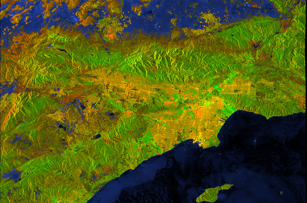
Coordinates: 33.8313°, -118.1745°
California
Resivoirs, Dams, Settlements Interactive Modifyable - @nasa MAP
BASEMAP : VIIRS/NPP Gap-Filled Lunar BRDF-Adjusted Nighttime Lights Daily L3 Global 15 arc-second Linear Lat Lon Grid NRT
ViiRS = Visible Infrared Imaging Radiometer Suite State:OPERATiONAL @Cityoflosangeles LocalLinuxGroup
@StateOfCalifornia … @emit-sds @nasa-jpl
Los Angeles StandingWater/Chlorophyll spots
D OD I NSTRUCTION 8510.01 RISK MANAGEMENT F RAMEWORK FOR D OD S YSTEMS
Los Angeles Emergency Operations Plan
<img alt="image" src="https://github.com/user-attachments/assets/cd83fdf1-064c-42b7-a0ae-d20e92625685" />
<img width="1920" height="1080" alt="image" src="https://github.com/user-attachments/assets/e14a323b-827d-4109-9f46-c4f7227147e3" />
[`The U.S. Space Force was established on Dec. 20, 2019`](https://www.defense.gov/News/News-Stories/article/article/2046035/trump-signs-law-establishing-us-space-force/), creating the first new branch of the armed services since 1947
The U.S. government is closed. However, because the information this website provides is necessary to protect life and property, this site will be updated and maintained during the federal government shutdown. For the latest forecasts and critical weather information, visit www.weather.gov.To learn more, visit commerce.gov. Automated data processing will continue to populate this site provided services do not require manual intervention. @nasa-jpl @nasa-develop
<img alt="image" src="https://github.com/user-attachments/assets/470a016d-1765-41d1-896d-a7fc9e7e316a" />
[STREAM](https://ladsweb.modaps.eosdis.nasa.gov/stream/map#map=14.25/-13157151.83/3995908.59&layers=aqv_chla_20250929_sentinel:1.00:0.00:30.00,aqv_chla_20250917_sentinel:1.00:0.00:30.00,aqv_chla_20251001_sentinel:1.00:0.00:30.00,aqv_chla_20251002_sentinel:1.00:0.00:30.00) + CHLOROPHYLL-a [Sentinel](https://eastcoast.coastwatch.noaa.gov/cw_olci_chl.php)
[Los Angeles Area Protected Areas] [_MAP_](https://firms.modaps.eosdis.nasa.gov/usfs/map/#d:24hrs,24hrs;l:fires_all,active-ca,active-usa,fire-perimeter,admin-usa,countries,landsat_human,earth;@-117.1,33.9,8.4z)
<img alt="FIRMS_24hrs,24hrs @-117 1,33 9,8 4z" src="https://github.com/user-attachments/assets/a2bd5c95-5bc9-4e7d-983e-4d0c79e6665b" />
<img alt="image" src="https://github.com/user-attachments/assets/71ec18e6-9d9f-4cfc-82a9-eed04f7d3a5b" />
[LinkToMap @usgs @stateofcalifornia](https://dashboard.waterdata.usgs.gov/app/nwd/en/?aoi=bbox-%5B-119.15285%2C33.72372%2C-116.86224%2C35.59589%5D&view=%7B%22basemap%22%3A%22EsriImagery2%22%2C%22bounds%22%3A%22-119.15285137547677%2C33.723722515863706%2C-116.8622364594797%2C35.59588890625661%22%2C%22insetMap%22%3Afalse%2C%22panel%22%3A%7B%22id%22%3A%22ViewerLayers%22%2C%22open%22%3Atrue%2C%22checkbox%22%3A%220%2C10%2C19%2C20%2C21%2C22%2C23%22%2C%22range%22%3A%220%3A1.0%2C1%3A1.0%2C2%3A1.0%2C3%3A1.0%2C4%3A1.0%2C5%3A1.0%2C6%3A1.0%2C7%3A1.0%2C8%3A0.8%2C9%3A0.3%2C10%3A0.5%2C11%3A0.5%2C12%3A0.5%2C13%3A0.5%2C14%3A0.5%2C15%3A0.5%2C16%3A0.5%2C17%3A1.0%2C18%3A1.0%2C19%3A1.0%2C20%3A1.0%22%2C%22select%22%3A%220%3A0%2C1%3A0%2C2%3A0%2C3%3A0%2C4%3A0%2C5%3A0%2C6%3A0%2C7%3A0%2C8%3A0%2C9%3A0%2C10%3A0%2C11%3A0%2C12%3A0%2C13%3A0%2C14%3A0%2C15%3A0%2C16%3A0%2C17%3A0%2C18%3A0%2C19%3A0%22%7D%7D )
<img alt="image" src="https://github.com/user-attachments/assets/bd0d3d36-8263-4861-8480-a2121260cbdd" />
[FireNews @nasa-jpl @blackgirlscode](https://www.universetoday.com/articles/the-los-angeles-fires-got-extremely-close-to-nasas-jpl-facility)
[Solid Steel (1st June) This week we welcome back Prefuse 73](https://soundcloud.com/ninja-tune/solid-steel-radio-show-162018-hour-1-prefuse-73?fbclid=IwY2xjawNMAaJleHRuA2FlbQIxMABicmlkETBQRjNqNUtZb2VpVm56bVFmAR4g93-IciH8RdNjFZobpoSZwn0uNt6UtLpXmNhs2mDZONUd64v5q6QkrSdN8g_aem_i4Nb8EB5qK-cjM4NYr-UXQ)
[aria](https://aria.jpl.nasa.gov/) [ppl](https://science.jpl.nasa.gov/projects/aria/)
# Los Angeles Area Land Displacement
[dev.openveda.cloud/stac/collections/opera_dist_S1_Jan2025_wildfire not working @nasa-develop @nasa-jpl](https://dev.openveda.cloud/stac/collections/opera_dist_S1_Jan2025_wildfire?.language=en)
[Try This Harmonized Landsat Sentinel-2 product Map] [OperaLandDisturbanceMap](https://search.earthdata.nasa.gov/search/granules?p=C2746980408-LPCLOUD&pg[0][v]=f&pg[0][gsk]=-start_date&q=C2746980408-LPCLOUD&sb[0]=-118.62193%2C32.79052%2C-116.91227%2C34.09716&tl=1700221400.412!4!!&lat=33.83489611994596&long=-117.99120018085311&zoom=9.929777945872225)
<img alt="image" src="https://github.com/user-attachments/assets/93c939a8-2f89-447c-b0b0-19aa0d5be047" />
[LosANGELES_OPERA 5.8mb png](https://ia600800.us.archive.org/24/items/RashardNasaEarthDataRiverWatch/LOSANGELES_LAND_DiSPLACEMENT__OPERA_L3_DISP-S1_IW_F18904_VV_20240701T135248Z_20241122T135247Z_v1.0_20250418T055222Z_BROWSE.png)
<img alt="image" src="https://github.com/user-attachments/assets/fd4fe482-3165-48cc-b4c0-546e2c104912" />
[ARiA/OPERA](https://gis.earthdata.nasa.gov/portal/apps/mapviewer/index.html?layers=0543f3b31a0e41f59be0d5cbc73d98f5)
<img alt="image" src="https://github.com/user-attachments/assets/beb3009e-7761-4865-b208-5c2b4bdba856" />
### OLD NEWS
- [READ @cityoflosangeles](https://www.earthdata.nasa.gov/news/los-angeles-wildfires-disrupting-daac-operations-data-access)
Los Angeles Wildfires Disrupting DAAC Operations and Data Access
NASA's Physical Oceanography Distributed Active Archive Center (PO.DAAC) and Jet Propulsion Laboratory (JPL) are experiencing operational outages that may affect data processing.
- Fires Tear Through Los Angeles [READ](https://earthobservatory.nasa.gov/images/153793/fires-tear-through-los-angeles)
- California deploys cutting-edge technologies for LA fires recovery with expanded NASA Jet Propulsion Laboratory partnership [READ](https://www.gov.ca.gov/2025/03/13/california-deploys-cutting-edge-technologies-for-la-fires-recovery-with-expanded-nasa-jet-propulsion-laboratory-partnership/)
- NASA's ARIA Maps California Wildfires from Space [READ @nasa-jpl](https://www.jpl.nasa.gov/news/nasas-aria-maps-california-wildfires-from-space/)
<iframe width="560" height="315" src="https://www.youtube.com/embed/IgUdJEgpxy8?si=AsKw6HPvBLBH3Dgm" title="@cbs-news-data @blackgirlscode YouTube video player" frameborder="0" allow="accelerometer; autoplay; clipboard-write; encrypted-media; gyroscope; picture-in-picture; web-share" referrerpolicy="strict-origin-when-cross-origin" allowfullscreen></iframe>
-
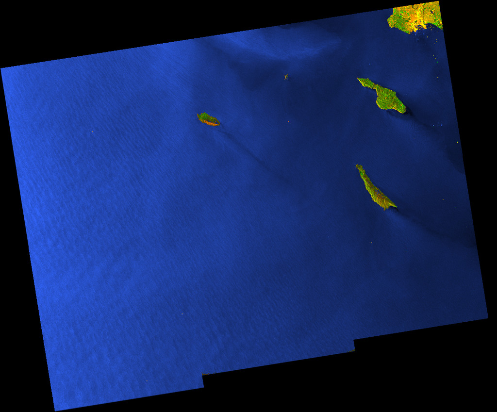
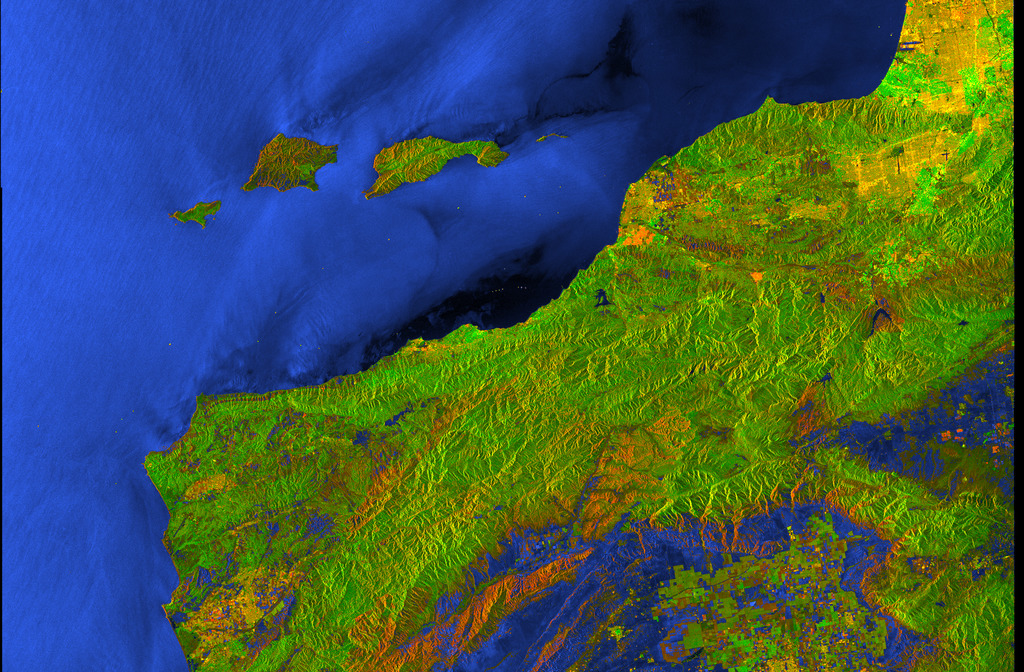
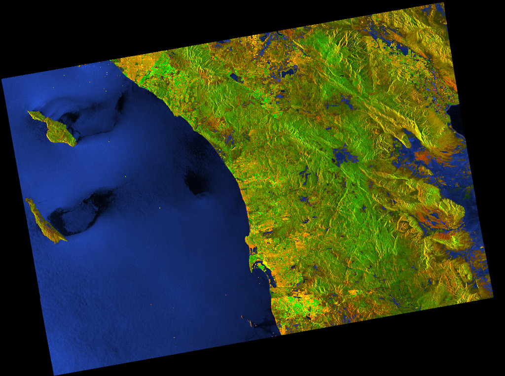
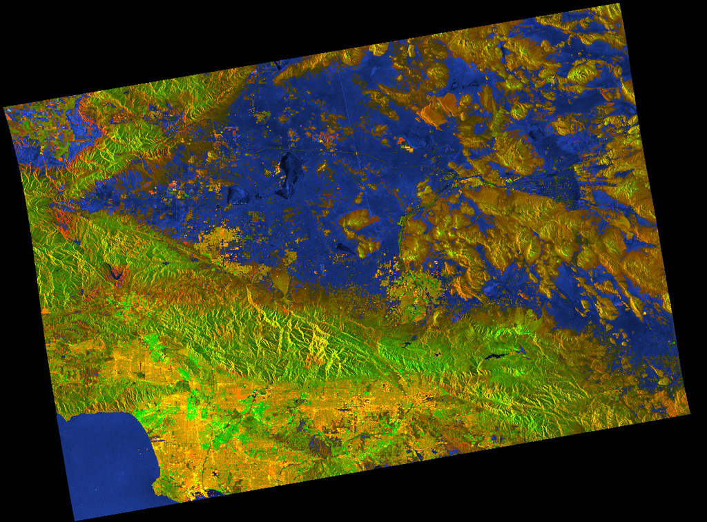
# Los Angelels [SarView](https://www.earthdata.nasa.gov/data/tools/vertex)
<div class="tupperware">
<a href="/rashardlearned/assets/images/gallery-lasar/AV320240905t175818_003_L2A_OE_f576f24d_RFL_ORT_BROWSE.jpg" target="_blank">
<img src="/rashardlearned/assets/images/gallery-lasar/AV320240905t175818_003_L2A_OE_f576f24d_RFL_ORT_BROWSE.jpg" alt="" class="img-thumbnail" />
</a>
<a href="/rashardlearned/assets/images/gallery-lasar/AV320250123t200630_006_L2A_OE_f576f24d_RFL_ORT_BROWSE.jpg" target="_blank">
<img src="/rashardlearned/assets/images/gallery-lasar/AV320250123t200630_006_L2A_OE_f576f24d_RFL_ORT_BROWSE.jpg" alt="" class="img-thumbnail" />
</a>
<a href="/rashardlearned/assets/images/gallery-lasar/AV320250123t202047_001_L2A_OE_f576f24d_RFL_ORT_BROWSE.jpg" target="_blank">
<img src="/rashardlearned/assets/images/gallery-lasar/AV320250123t202047_001_L2A_OE_f576f24d_RFL_ORT_BROWSE.jpg" alt="" class="img-thumbnail" />
</a>
<a href="/rashardlearned/assets/images/gallery-lasar/AV320250123t202047_005_L2A_OE_f576f24d_RFL_ORT_BROWSE.jpg" target="_blank">
<img src="/rashardlearned/assets/images/gallery-lasar/AV320250123t202047_005_L2A_OE_f576f24d_RFL_ORT_BROWSE.jpg" alt="" class="img-thumbnail" />
</a>
<a href="/rashardlearned/assets/images/gallery-lasar/AV320250123t202605_002_L2A_OE_f576f24d_RFL_ORT_BROWSE.jpg" target="_blank">
<img src="/rashardlearned/assets/images/gallery-lasar/AV320250123t202605_002_L2A_OE_f576f24d_RFL_ORT_BROWSE.jpg" alt="" class="img-thumbnail" />
</a>
<a href="/rashardlearned/assets/images/gallery-lasar/S1A_IW_GRDH_1SDV_20250906T015019_20250906T015044_060861_079410_B3CE.jpg" target="_blank">
<img src="/rashardlearned/assets/images/gallery-lasar/S1A_IW_GRDH_1SDV_20250906T015019_20250906T015044_060861_079410_B3CE.jpg" alt="" class="img-thumbnail" />
</a>
<a href="/rashardlearned/assets/images/gallery-lasar/S1A_IW_GRDH_1SDV_20250911T015845_20250911T015910_060934_0796FA_B97D.jpg" target="_blank">
<img src="/rashardlearned/assets/images/gallery-lasar/S1A_IW_GRDH_1SDV_20250911T015845_20250911T015910_060934_0796FA_B97D.jpg" alt="" class="img-thumbnail" />
</a>
<a href="/rashardlearned/assets/images/gallery-lasar/S1A_IW_GRDH_1SDV_20250918T015036_20250918T015101_061036_079B18_875A.jpg" target="_blank">
<img src="/rashardlearned/assets/images/gallery-lasar/S1A_IW_GRDH_1SDV_20250918T015036_20250918T015101_061036_079B18_875A.jpg" alt="" class="img-thumbnail" />
</a>
<a href="/rashardlearned/assets/images/gallery-lasar/S1A_IW_GRDH_1SDV_20250918T135250_20250918T135315_061043_079B66_E8A8.jpg" target="_blank">
<img src="/rashardlearned/assets/images/gallery-lasar/S1A_IW_GRDH_1SDV_20250918T135250_20250918T135315_061043_079B66_E8A8.jpg" alt="" class="img-thumbnail" />
</a>
<a href="/rashardlearned/assets/images/gallery-lasar/S1A_IW_GRDH_1SDV_20250923T015845_20250923T015910_061109_079DFA_33E2.jpg" target="_blank">
<img src="/rashardlearned/assets/images/gallery-lasar/S1A_IW_GRDH_1SDV_20250923T015845_20250923T015910_061109_079DFA_33E2.jpg" alt="" class="img-thumbnail" />
</a>
<a href="/rashardlearned/assets/images/gallery-lasar/S1A_IW_GRDH_1SDV_20250930T135250_20250930T135315_061218_07A273_F068.jpg" target="_blank">
<img src="/rashardlearned/assets/images/gallery-lasar/S1A_IW_GRDH_1SDV_20250930T135250_20250930T135315_061218_07A273_F068.jpg" alt="" class="img-thumbnail" />
</a>
<a href="/rashardlearned/assets/images/gallery-lasar/S1A_IW_GRDH_1SDV_20251005T015816_20251005T015845_061284_07A50F_3B68.jpg" target="_blank">
<img src="/rashardlearned/assets/images/gallery-lasar/S1A_IW_GRDH_1SDV_20251005T015816_20251005T015845_061284_07A50F_3B68.jpg" alt="" class="img-thumbnail" />
</a>
<a href="/rashardlearned/assets/images/gallery-lasar/S1A_IW_GRDH_1SDV_20251005T015845_20251005T015910_061284_07A50F_4DEE.jpg" target="_blank">
<img src="/rashardlearned/assets/images/gallery-lasar/S1A_IW_GRDH_1SDV_20251005T015845_20251005T015910_061284_07A50F_4DEE.jpg" alt="" class="img-thumbnail" />
</a>
<a href="/rashardlearned/assets/images/gallery-lasar/S1C_IW_GRDH_1SDV_20250912T014931_20250912T014956_004085_0081E7_E98D.jpg" target="_blank">
<img src="/rashardlearned/assets/images/gallery-lasar/S1C_IW_GRDH_1SDV_20250912T014931_20250912T014956_004085_0081E7_E98D.jpg" alt="" class="img-thumbnail" />
</a>
<a href="/rashardlearned/assets/images/gallery-lasar/S1C_IW_GRDH_1SDV_20250912T135135_20250912T135200_004092_008227_4919.jpg" target="_blank">
<img src="/rashardlearned/assets/images/gallery-lasar/S1C_IW_GRDH_1SDV_20250912T135135_20250912T135200_004092_008227_4919.jpg" alt="" class="img-thumbnail" />
</a>
<a href="/rashardlearned/assets/images/gallery-lasar/S1C_IW_GRDH_1SDV_20250917T015724_20250917T015753_004158_00841C_FF25.jpg" target="_blank">
<img src="/rashardlearned/assets/images/gallery-lasar/S1C_IW_GRDH_1SDV_20250917T015724_20250917T015753_004158_00841C_FF25.jpg" alt="" class="img-thumbnail" />
</a>
<a href="/rashardlearned/assets/images/gallery-lasar/S1C_IW_GRDH_1SDV_20251006T014906_20251006T014931_004435_008C8B_0E91.jpg" target="_blank">
<img src="/rashardlearned/assets/images/gallery-lasar/S1C_IW_GRDH_1SDV_20251006T014906_20251006T014931_004435_008C8B_0E91.jpg" alt="" class="img-thumbnail" />
</a>
<a href="/rashardlearned/assets/images/gallery-lasar/S1C_IW_GRDH_1SDV_20251006T014931_20251006T014956_004435_008C8B_0EE3.jpg" target="_blank">
<img src="/rashardlearned/assets/images/gallery-lasar/S1C_IW_GRDH_1SDV_20251006T014931_20251006T014956_004435_008C8B_0EE3.jpg" alt="" class="img-thumbnail" />
</a>
<a href="/rashardlearned/assets/images/gallery-lasar/S1C_IW_GRDH_1SDV_20251006T135136_20251006T135201_004442_008CCB_1D55.jpg" target="_blank">
<img src="/rashardlearned/assets/images/gallery-lasar/S1C_IW_GRDH_1SDV_20251006T135136_20251006T135201_004442_008CCB_1D55.jpg" alt="" class="img-thumbnail" />
</a>
<a href="/rashardlearned/assets/images/gallery-lasar/download.png" target="_blank">
<img src="/rashardlearned/assets/images/gallery-lasar/download.png" alt="" class="img-thumbnail" />
</a>
<a href="/rashardlearned/assets/images/gallery-lasar10-9/S1A_IW_GRDH_1SDV_20250930T135250_20250930T135315_061218_07A273_F068.jpg" target="_blank">
<img src="/rashardlearned/assets/images/gallery-lasar10-9/S1A_IW_GRDH_1SDV_20250930T135250_20250930T135315_061218_07A273_F068.jpg" alt="" class="img-thumbnail" />
</a>
<a href="/rashardlearned/assets/images/gallery-lasar10-9/S1A_IW_GRDH_1SDV_20251005T015816_20251005T015845_061284_07A50F_3B68.jpg" target="_blank">
<img src="/rashardlearned/assets/images/gallery-lasar10-9/S1A_IW_GRDH_1SDV_20251005T015816_20251005T015845_061284_07A50F_3B68.jpg" alt="" class="img-thumbnail" />
</a>
<a href="/rashardlearned/assets/images/gallery-lasar10-9/S1A_IW_GRDH_1SDV_20251005T015845_20251005T015910_061284_07A50F_4DEE.jpg" target="_blank">
<img src="/rashardlearned/assets/images/gallery-lasar10-9/S1A_IW_GRDH_1SDV_20251005T015845_20251005T015910_061284_07A50F_4DEE.jpg" alt="" class="img-thumbnail" />
</a>
<a href="/rashardlearned/assets/images/gallery-lasar10-9/S1C_IW_GRDH_1SDV_20251006T014906_20251006T014931_004435_008C8B_0E91.jpg" target="_blank">
<img src="/rashardlearned/assets/images/gallery-lasar10-9/S1C_IW_GRDH_1SDV_20251006T014906_20251006T014931_004435_008C8B_0E91.jpg" alt="" class="img-thumbnail" />
</a>
<a href="/rashardlearned/assets/images/gallery-lasar10-9/S1C_IW_GRDH_1SDV_20251006T014931_20251006T014956_004435_008C8B_0EE3.jpg" target="_blank">
<img src="/rashardlearned/assets/images/gallery-lasar10-9/S1C_IW_GRDH_1SDV_20251006T014931_20251006T014956_004435_008C8B_0EE3.jpg" alt="" class="img-thumbnail" />
</a>
<a href="/rashardlearned/assets/images/gallery-lasar10-9/S1C_IW_GRDH_1SDV_20251006T135136_20251006T135201_004442_008CCB_1D55.jpg" target="_blank">
<img src="/rashardlearned/assets/images/gallery-lasar10-9/S1C_IW_GRDH_1SDV_20251006T135136_20251006T135201_004442_008CCB_1D55.jpg" alt="" class="img-thumbnail" />
</a>
<a href="/rashardlearned/assets/images/gallery-lasar10-9/l" target="_blank">
<img src="/rashardlearned/assets/images/gallery-lasar10-9/l" alt="" class="img-thumbnail" />
</a>
</div>
[@blackgirlscode](https://solarsystem.nasa.gov/downloads/download_6302_1757366839.zip) + [fb @nasa-jpl @nasa-pds](https://www.facebook.com/permalink.php?story_fbid=pfbid0tggTUKoeRmAokDpgQf4koCTtVg3g2pa9iHguPGC4mbL3Rfn21wo7wJp4Whnjq5YCl&id=100084464911565)
[Caltrans Encampment Resource Network Tutorial](https://www.youtube.com/watch?v=wIk3gRsaSuI) + [MAP @cagov](https://quickmap.dot.ca.gov/) [culvercity.gov @stateofcalifornia `Encampment Resolution`](https://www.culvercity.gov/Services/Housing-Homeless-Human-Services/Homeless-Reporting-Dashboard/Encampment-Resolution) [stream eosdis.nasa.gov](https://ladsweb.modaps.eosdis.nasa.gov/stream/)
The Los Angeles City Hall, Calif.
[STEREOGRAPH](https://www.loc.gov/item/2016652050/)
[LA 92](https://youtu.be/uaotkHlHJwo?si=9Ik0RxQ-ur_k_WhI)
[LA92 Alt](https://www.nationalgeographic.com/tv/movies-and-specials/dab898d3-4259-4f15-bdc8-1ed62c7cfc5e) [
LA92 Panel - Live National Geographic](https://youtu.be/dWGUgjgOW_Y) [LA Stories: The 1992 Riots That Shook the City](https://youtu.be/oyIZp3XZ6Hs) [“ WATTS RIOT OR REVOLT? ” AUGUST, 1965 WATTS, LOS ANGELES RACE RIOTS SPECIAL REPORT PART 1 SM10075a](https://www.youtube.com/watch?v=MgXGIP6suow) ["A CITY AND ITS PEOPLE " A DAY IN 1960s LOS ANGELES CALIFORNIA EDUCATIONAL FILM](https://stock.periscopefilm.com/6625-a-city-and-its-a-people-see-xd72474/) [XD72474](https://www.youtube.com/watch?v=NHD5W-nj0Zo)
# Dear MAyor ([Karen Bass](https://www.kqed.org/news/11932548/karen-bass-wins-la-mayoral-race))
Hi, Its Rasahrd from NasaJpl the [YA](https://www.reddit.com/r/YAlit/comments/18xxv05/is_there_a_list_of_must_read_ya_books_especially/) Somali that takes short naps on the back portch of [city hall](https://www.laconservancy.org/learn/historic-places/los-angeles-city-hall/). I am following your instructions in the [County of Los Angeles Emergency Survival Guide](https://lacounty.gov/wp-content/uploads/2022/03/1058408_2019_ESG_English_Webversion1.pdf)
it reads
>This Guide will help you to better prepare for, respond to and recover from disasters that face Los Angeles County. Our goal is to provide tips that assist you to be self-sufficient after a disaster
<img src= "https://lacounty.gov/wp-content/uploads/2022/03/Emerg.Survival.Guide_-232x300.jpg" alt="Emergency Survival Guide" style="width:232px;height:300px;margin-right:5px;padding:10px;" align="left" alt="Pineapple" />
[This guide will help you to better prepare for, respond to and recover from disasters that face Los Angeles County.](https://lacounty.gov/emergency/preparedness/emergency-survival-guide/)
Its hard to explin everything in one quick note. But basically I was in Atlanta and [My Wife Vanished](https://www.essence.com/news/erika-kelly-missing-atlanta-georgia/) and i got destituted by ppl throwing me in the mental hospital a girl i was told was my cousin [Kelly Danielle](https://www.instagram.com/daniellekellybjj/p/Cdw9_9nsfEe/?img_index=1) Renee Williams daughter by Winfred. My daughter was taken and i cannot even get a cellphone.
I eat at [St_Francis](https://www.stfranciscenterla.org/) once a day and [Reality Church in Hollywood](https://realityla.com/) 5 days a week since i got suspended from [Long Beach's Billie Jean Library](https://www.longbeach.gov/library/locations/main-library/)... So i need you to look at this conversation. Its the kidnapper of my wife#2/3 [She is no longer you wife](https://vimeo.com/396000267)
im always running from ppl bc she is in the entertainment industry. They have an infrastructure that cuts the girls off from contact outside a [Streaming Media Cult](https://www.socialmediatoday.com/news/tiktok-explores-streaming-studios-la-facilitate-live-shopping/706040/)
anyway last night [June 9th](https://www.amoeba.com/our-stores/store-news/469/the-2024-la-pride-parade-block-party-in-hollywood-sunday-june-9th-469/) a gaurd with [Allied Universal](https://ausnewsroom.aus.com/) The guy with scruffy hair. Hes white he called this South American Assasin and he cahsed me with a holstered gun and bullet proof [Tactical Vest](https://www.blackhawk.com/tactical-nylon/tactical-vests/) out of the [subway](https://ktla.com/news/local-news/pedestrian-suffers-major-injuries-after-being-hit-by-l-a-subway-train/)
[Los Angeles 1940s in Color! Driving Downtown w/sound design added](https://www.youtube.com/watch?v=OiShtKv43hg) [California 1950s, Driving Wilshire Blvd in color w/sound design added](https://www.youtube.com/watch?v=5fL8n_aAisQ)
# The Los Angeles Times 1895-08-15
<iframe src="https://archive.org/embed/sim_los-angeles-times_the-los-angeles-times_1895-08-15" width="560" height="384" frameborder="0" webkitallowfullscreen="true" mozallowfullscreen="true" allowfullscreen></iframe>
[Normani - Insomnia (Audio)](https://youtu.be/A7iWX2excWw?si=0tTzNJKSucAJGA2l) [Normani - Still (Audio)](https://youtu.be/Shz79-CRyzc?si=3Af7_YgLyLKD59g9) [Pilot Episode I, Darrin, Take This Witch, Samantha S1E1 Bewitched](https://youtu.be/oB_vXlgcCpw?si=O_TWnWDvSjS7-kYS)
The Port of Los Angeles: a History
<iframe src="https://archive.org/embed/csmha_000279" width="640" height="480" frameborder="0" webkitallowfullscreen="true" mozallowfullscreen="true" allowfullscreen></iframe>
[An illustrated history of Los Angeles County, California](https://archive.org/details/illustratedhisto01lewi/page/575/mode/2up)
<iframe src="https://archive.org/embed/illustratedhisto01lewi" width="560" height="384" frameborder="0" webkitallowfullscreen="true" mozallowfullscreen="true" allowfullscreen></iframe>
[LaHistoryArchive](https://www.lahistoryarchive.org/) [East Los Angeles : history of a barrio](https://archive.org/details/eastlosangeleshi0000romo/page/n9/mode/2up) [Front page : 100 years of the Los Angeles times, 1881-1981](https://archive.org/details/frontpage100year0000unse/page/n9/mode/2up) [The history of forgetting : Los Angeles and the erasure of memory](https://archive.org/details/historyofforgett0000klei)
### History of Los Angeles County, California, with illustrations descriptive of its scenery, residences, fine blocks and manufactories
[PDF](https://dn720109.ca.archive.org/0/items/historyoflosange00wils/historyoflosange00wils.pdf)
<iframe src="https://archive.org/embed/historyoflosange00wils" width="560" height="384" frameborder="0" webkitallowfullscreen="true" mozallowfullscreen="true" allowfullscreen></iframe>
El Pueblo de Nuestra Señora la Reina de los Ángeles del Río de Porciúncula (English: The town of Our Lady the Queen of the Angels of the River of the Porciuncula), shortened to Pueblo de los Ángeles, was the Spanish civilian pueblo settled in 1781, which became the [American metropolis of Los Angeles](https://en.wikipedia.org/wiki/Pueblo_de_Los_%C3%81ngeles#Government). The pueblo was built using labor from the adjacent village of Yaanga and was totally dependent on local Indigenous labor for its survival
[Read LaReina PDF](https://ia601405.us.archive.org/14/items/lareinalosangele00hill/lareinalosangele00hill.pdf) [related tweet](https://x.com/RicoThaka/status/1785810853646021084) [WELCOME TO LA REINA](https://www.lareinala.com/our-history) [The History of Los Angeles](https://lacity.gov/government/history-los-angeles) Historically, the areas of present day Los Angeles was home to the Chumash and Tongva Native American tribes. On September 4, 1781 a group of settlers consisting of 14 families numbering 44 individuals of Native American, African and European heritage journeyed more than one-thousand miles across the desert from present-day northern Mexico and established a farming community in the area naming it "El Pueblo de Nuestra Señora la Reina de los Ángeles de Porciúncula" which in English translated to "The Town of Our Lady the Queen of the Angels of Porciúncula". Over time this community would grow under the flags of Spain, Mexico and eventually the United States to become one of the largest metropolitan cities in the world, the City of [Los Angeles](https://en.wikipedia.org/wiki/Pueblo_de_Los_%C3%81ngeles).
 By Unknown author - <a rel="nofollow" class="external free" href="https://tessa.lapl.org/cdm/search/searchterm/00032727">https://tessa.lapl.org/cdm/search/searchterm/00032727</a>, Public Domain, <a href="https://commons.wikimedia.org/w/index.php?curid=7035575">Link</a>

### TCL formerly Mann's Chinese Theater

[How Internet Traffic works (Warriors of the Net).mp4](https://archive.org/download/ComputerHackingDocumentriesMegaCollection/Hack%20-%20How%20Internet%20Traffic%20works%20%28Warriors%20of%20the%20Net%29.mp4) https://archive.org/download/ComputerHackingDocumentriesMegaCollection

Dear MAyor (Karen Bass)
[Allied Filling Jobs](https://labusinessjournal.com/technology/allied-universal-struggles-fill-thousands-security/)
[ LA Local News Judge Orders Arbitration of Allied Security Guard's Harassment Suit](https://kfiam640.iheart.com/featured/la-local-news/content/2024-01-10-judge-orders-arbitration-of-allied-security-guards-harassment-suit/)]
[BMO Stadium selects Allied Universal as preferred event services provider](https://www.securityinfowatch.com/security-executives/protective-operations-guard-services/press-release/53099143/allied-universal-bmo-stadium-selects-allied-universal-as-preferred-event-services-provider)
[Allied Universal to hire 450 security officers, mostly in LA County](https://www.dailynews.com/2021/03/25/allied-universal-to-hire-450-security-officers-mostly-in-la-county/?clearUserState=true)

[BODY ARMOR FOR THE SECURITY INDUSTRY](https://www.safeguardclothing.com/blogs/articles/body-armor-for-the-security-industry)

[Satun;ring orbit study](https://solarsystem.nasa.gov/downloads/download_6355_1761018085.zip)

[W00086580.jpg](https://solarsystem.nasa.gov/raw_images/333720/?layout=hds) was taken on 2014-02-11 03:58 (PST) and received on Earth 2014-02-14 07:29 (PST). The camera was pointing toward Saturn, and the image was taken using the CL1 and CL2 filters. This image has not been validated or calibrated. A validated/calibrated image will be archived with the NASA Planetary Data System
## WildFireS

[Nasa_FiRMS](https://firms.modaps.eosdis.nasa.gov/map/#d:24hrs;@-116.6,34.8,6.9z) [US/Canada FireMaps](https://firms.modaps.eosdis.nasa.gov/usfs/map/#d:24hrs;@-100.0,40.0,4.0z)
<div class="mro_banner">
<img src="https://d2pn8kiwq2w21t.cloudfront.net/images/27-mission-current-MRO.height-700.png" alt="Nature" >
<div class="innertext-block">
<h4>Los Angeles</h4>
<p>hole to another universe</p>
</div>
</div>
<div class='twoPanelSpread'>
<div class='row'>
<div class='panelColumn'>
<div class='leftColumn'>
<a href="https://upload.wikimedia.org/wikipedia/commons/thumb/3/30/Frank_Lloyd_Wright_portrait.jpg/564px-Frank_Lloyd_Wright_portrait.jpg"> <img src="https://upload.wikimedia.org/wikipedia/commons/thumb/3/30/Frank_Lloyd_Wright_portrait.jpg/564px-Frank_Lloyd_Wright_portrait.jpg" alt="1945 dessau" ></a>
</div>
</div>
<div class='panelColumn'>
<div class='rightColumn'>
<a href="https://upload.wikimedia.org/wikipedia/commons/thumb/3/30/Frank_Lloyd_Wright_portrait.jpg/564px-Frank_Lloyd_Wright_portrait.jpg"> <img src="https://upload.wikimedia.org/wikipedia/commons/thumb/3/30/Frank_Lloyd_Wright_portrait.jpg/564px-Frank_Lloyd_Wright_portrait.jpg" alt="LE DDT A DESSAU" ></a>
</div>
</div>
</div>
</div>
[Frank Lloyd Wright Sr.](https://franklloydwright.org/) (June 8, 1867 – April 9, 1959) was an American architect, designer, writer, and educator. He designed more than 1,000 structures over a creative period of 70 years. Wright played a key role in the architectural movements of the twentieth century, influencing architects worldwide through his works and mentoring hundreds of apprentices in his Taliesin Fellowship.[1][2] Wright believed in designing in harmony with humanity and the environment, a philosophy he called organic architecture.
[Hollyhock House, 4800 Hollywood Boulevard, Los Angeles, Los Angeles County, CA](https://www.loc.gov/resource/hhh.ca0231.photos/)
<div class='twoPanelSpread'>
<div class='row'>
<div class='panelColumn'>
<div class='leftColumn'>
<a href="https://tile.loc.gov/storage-services/service/pnp/habshaer/ca/ca0200/ca0231/photos/012065pv.jpg"> <img src="https://tile.loc.gov/storage-services/service/pnp/habshaer/ca/ca0200/ca0231/photos/012065pv.jpg" alt="HollyHockHouse " ></a>
</div>
</div>
<div class='panelColumn'>
<div class='rightColumn'>
<a href="https://tile.loc.gov/storage-services/service/pnp/habshaer/ca/ca0200/ca0231/photos/012063pv.jpg"> <img src="https://tile.loc.gov/storage-services/service/pnp/habshaer/ca/ca0200/ca0231/photos/012063pv.jpg" alt="LE DDT A DESSAU" ></a>
</div>
</div>
</div>
</div>
This philosophy was exemplified in [Fallingwater (1935)](https://fallingwater.org/), which has been called "the best all-time work of American architecture" [WikiPedia](https://en.wikipedia.org/wiki/Frank_Lloyd_Wright) [MoMA](https://www.moma.org/calendar/exhibitions/1660)

 [Frank Lloyd Wright's Fallingwater: Inside the House That Forever Changed Architecture](https://www.youtube.com/watch?v=mwGz58GIFYQ)
# Viking Project

### OCCURRED 47 YEARS AGO
NASA's Viking Project found a place in history when it became the first U.S. mission to land a spacecraft safely on the surface of Mars and return images of the surface. [ReadMore](https://science.nasa.gov/mission/viking/) + [Viking Lander High Resolution Mosaics](https://planetarydata.jpl.nasa.gov/img/data/vl1_vl2-m-lcs-5-midr-pv0.x/vl_2011/hires/hires.html)
### PIA02985: Dust storm in the Thaumasia region of Mars
#### Original Caption Released with Image:
This Viking Orbiter 2 image shows a large dust storm over the Thaumasia region on Mars. This large disturbance soon grew into the first global dust storm observed by the Viking Orbiters. This image was taken at 9:00 local time near perihelion when heating of Mars is at a maximum. The image is at 1400 km across and north is at 1:00. (Viking Orbiter 176B02).
Image Credit:
[NASA/JPL](https://github.com/customer-stories/jpl)
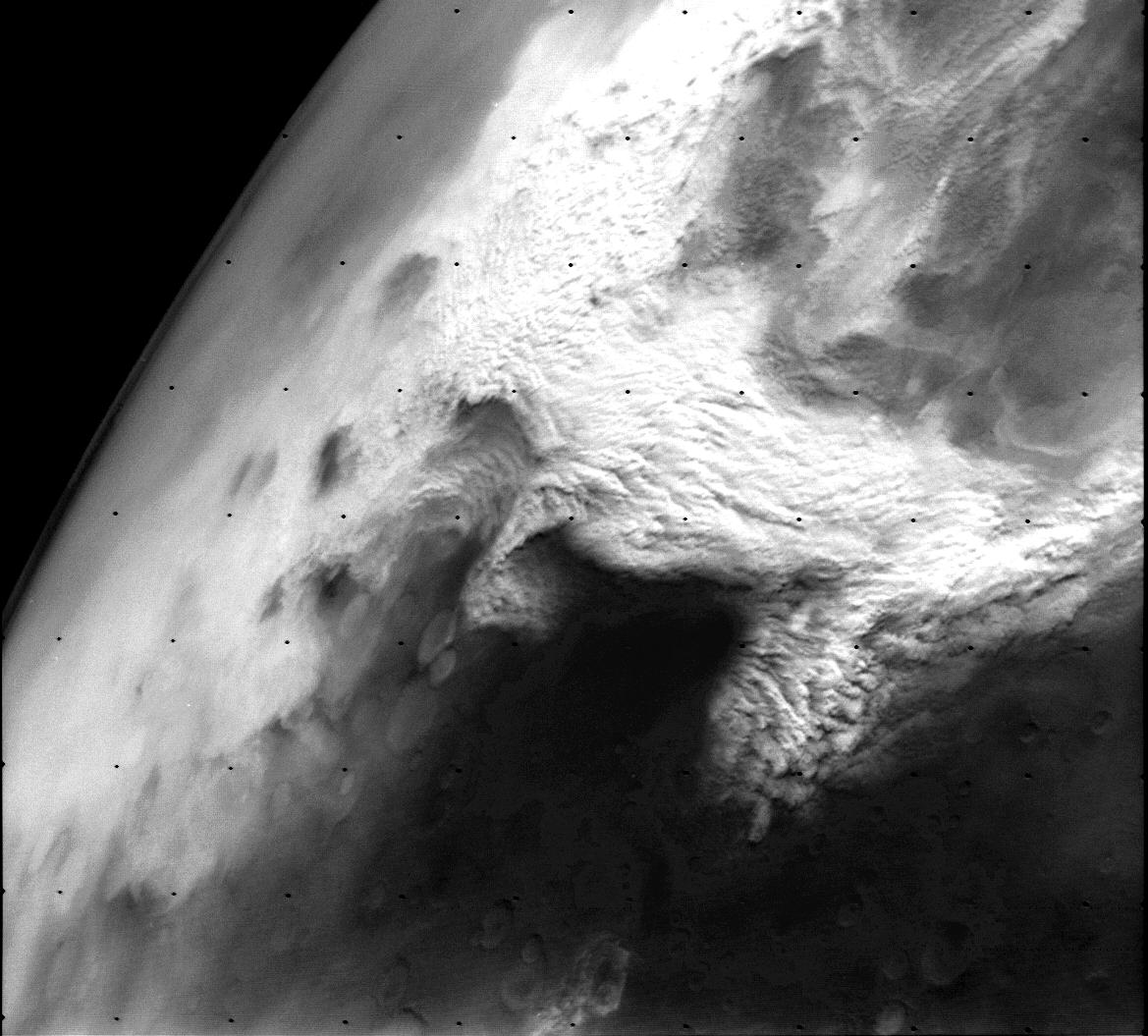
[Seal of Los Angeles County, California](https://en.wikipedia.org/wiki/Seal_of_Los_Angeles_County,_California)

[Expedition 66 Astronaut Tom Marshburn Answers Los Angeles Student Questions - March 21, 2022](https://images.nasa.gov/details/iss066m260801629_Expedition_66_Education_Inflight_Orville_Wright%20_Middle_School_STEAM_220321)
Aboard the International Space Station, NASA Expedition 66 Flight Engineer Tom Marshburn answered pre-recorded questions about life and work on the orbital laboratory during an in-flight event March 21 with the [Orville Wright STEAM Middle School in Las Angeles, California](https://www.wrightms.org/apps/pages/index.jsp?uREC_ID=450492&type=d). Marshburn is in the midst of a planned six-month mission living and working aboard the microgravity laboratory to advance scientific knowledge and demonstrate new technologies for future human and robotic exploration missions as part of NASA’s Moon and Mars exploration approach, including lunar missions through [NASA’s Artemis program.](https://www.nasa.gov/humans-in-space/artemis/) [Orville Wright](https://www.wrightms.org/apps/pages/index.jsp?uREC_ID=464041&type=d)
[Mapping Makes an Impact in the Fight to Reduce Child Exploitation](https://www.esri.com/about/newsroom/blog/mapping-to-reduce-child-exploitation/)
The surreptitious nature of child sex trafficking, with offenders keeping children on the move and crossing jurisdictional lines, makes it difficult to locate and protect children and track down those who exploit them. The National Center for Missing & Exploited Children (NCMEC) takes a data-centric approach that empowers cross-agency collaboration. [Esri_BLOG](https://www.esri.com/about/newsroom/esri-blog/overview/)
[Cambodian Genocide](https://sfi.usc.edu/collections/cambodian-genocide)
In 1975, a communist regime known as the Khmer Rouge conquered the Cambodian capital of Phnom Penh. The occupation set in motion a four-year campaign of genocide that would wipe out 2 million people – a quarter of the country’s population. Developed through a partnership between [USC Shoah Foundation](https://sfi-ids.usc.edu/Account/Login?ReturnUrl=%2Fconnect%2Fauthorize%2Fcallback%3Fclient_id%3D1FAAA958-8B27-4990-9F8C-A4E87AB5DVHA%26redirect_uri%3Dhttps%253A%252F%252Fvha.usc.edu%252Fsignin-oidc%26response_type%3Dcode%26scope%3Dopenid%2520profile%2520VHAP.VHA.API%2520offline_access%26code_challenge%3Dj-_RknK9RIc7Pso6-mKaEPz_X3ODNR2qpvf6WqyfbkU%26code_challenge_method%3DS256%26response_mode%3Dform_post%26nonce%3D638539894167970085.MmFhOWNlNjAtZTJhZi00YTkzLWJkMjYtNWQ4OGM1ZmE3OTgyZTU5MDVjZDktYzdkZC00ZjYzLWEyM2ItNTlkNTc5OTIxOGM2%26registerUrl%3Dhttps%253A%252F%252Fvha.usc.edu%252Fregister%26state%3DCfDJ8EhhOkaa9UZDriomdFQiWCrBmNmtIEdL2GTZUhyTk0OOzrX8tEtBBWjky01lJKFBPUDOX-Hlwcvib-Pw6sXzwlLaVPv_bZE4lVzFPjARPx0YRjY738RcguOnXPs8tbWJenHpdtWYAhi_Ad5vLeL1f1yDIBwKUI6-w0ZScW00hIYarPAQmVAXcLgQLTiyuackG_vy1TCwbEkgitad0BBfJDh_jq3iP4YxvyjFexV68gVXDXl_q1eGSEOK10IiMQHf6IB3BaPpR55aqpJo9_sjb4vTv4wi1u0n1ONYSG72H2CoOVJXdsSaX7y0psA54vi1w38596Yq49qgc-2nFbws0aKVxQMeobFERruM5WmeOVYLkkkdv7mbRk5WVHya6X0how%26x-client-SKU%3DID_NETSTANDARD2_0%26x-client-ver%3D6.10.0.0) and the [Documentation Center of Cambodia](https://www.dccam.org/), the Cambodian Genocide Collection offers testimonies of survivors who escaped the killings from 1975 to 1979...[ReadMoreatUSC](https://vha.usc.edu/home)

# UrbanTypeface or Fashion ?


### Divide and Conquer (film)
[Divide and Conquer (1943)](https://upload.wikimedia.org/wikipedia/commons/5/5d/Why_We_Fight-_Divide_and_Conquer.webm) is the third film of Frank Capra's Why We Fight propaganda film series and deals with the Nazi conquest of Western Europe in 1940. [ReadMoreOnWikiPedia](https://en.wikipedia.org/wiki/Divide_and_Conquer_(film))
<video controls
src="https://upload.wikimedia.org/wikipedia/commons/5/5d/Why_We_Fight-_Divide_and_Conquer.webm"
poster="https://pbs.twimg.com/media/GP_VBuEbEAEmjbi?format=jpg&name=large">
Sorry, your browser doesn't support embedded videos, but don't worry, you can
<a href="https://upload.wikimedia.org/wikipedia/commons/5/5d/Why_We_Fight-_Divide_and_Conquer.webm">download it</a>
and watch it with your favorite video player!
</video>
### [Divide and Conquer](https://commons.wikimedia.org/wiki/File:U.S._War_Department_-_Divide_and_Conquer_(1943).webm)
Divide and rule policy (Latin: divide et impera), or divide and conquer, in politics and sociology is gaining and maintaining power divisively. This includes the exploitation of existing divisions within a political group by its political opponents, and also the deliberate creation or strengthening of such divisions.
The strategy, but not the phrase, applies in many ancient cases: the example of Aulus Gabinius exists, parting the Jewish nation into five conventions, reported by Flavius Josephus in Book I, 169–170 of The Jewish War (De bello Judaico).[1] Strabo also reports in Geographica, 8.7.3[2] that the Achaean League was gradually dissolved when it became part of the Roman province of Macedonia, as the Romans treated the various states differently, wishing to preserve some and to destroy others.[citation needed]
Elements of this technique involve: [citation needed]
creating or encouraging divisions among the subjects to prevent alliances that could challenge the sovereign and distributing forces so that they overpower each other.
aiding and promoting those who are willing to cooperate with the sovereign
fostering distrust and enmity between local rulers
encouraging meaningless expenditures that reduce the capability for political and military spending [Read<oreOnWikiPedia](https://en.wikipedia.org/wiki/Divide_and_rule) [imdb](https://www.imdb.com/title/tt0173769/)
[Murphy Ranch Road Trail](https://trails.lacounty.gov/Trail/311/murphy-ranch-road-trail) [Murphy’s Ranch: Abandoned Nazi Camp in Santa Monica](https://californiathroughmylens.com/murphys-ranch-abandoned-nazi-camp-in-santa-monica/)
<div class="strawberry heading"><img src="https://d2pn8kiwq2w21t.cloudfront.net/images/27-mission-current-MRO.height-700.png" />
<div></div>
<div></div>
<div></div>
<div></div>
<div></div>
</div>
<img alt="image" src="https://github.com/user-attachments/assets/dd12c5e3-bea3-4691-a96b-f0c7364f7aa1" />
<img alt="image" src="https://github.com/user-attachments/assets/b021997d-e137-4fa5-916e-f3eec6f512aa" />
[New PDS Beta Site is Live](https://pds.mcp.nasa.gov/portal/)
@blackgirlscode @cityoflosangeles @nasa-jpl @emit-sds
<img alt="image" src="https://github.com/user-attachments/assets/b6c8898f-2eee-48c5-b54a-f579cd2093ed" />
<iframe src="https://www.facebook.com/plugins/post.php?href=https%3A%2F%2Fwww.facebook.com%2Fpermalink.php%3Fstory_fbid%3Dpfbid02Cd9DRK7SkH9oh8SzBJmQ1Y5wXR4forgt311AuVo59LvdtiWUhXUqXot1jRUSub7Nl%26id%3D100084464911565&show_text=true&width=500" width="500" height="779" style="border:none;overflow:hidden" scrolling="no" frameborder="0" allowfullscreen="true" allow="autoplay; clipboard-write; encrypted-media; picture-in-picture; web-share"></iframe>
<img alt="image" src="https://github.com/user-attachments/assets/d02bcc9e-ed28-4dee-a876-3962ef899d6a" />
# @nasa-jpl @nasa-pds
## issue front end has not updated since july 2015
@nasa-jpl its a [Langley Product](https://youtu.be/ks1SRA6Sljw) @nasa-develop
this is the last image, i will look for data stores my next sech
[TroubleReport on @meta @nasa](https://www.facebook.com/gill.broussard/posts/pfbid0y7YiBMLaM4q9aQKJzoUnzrXZ39c6x7H6dQGYyASGmVyV3z9SLEAi8Le5WN3KJQ8rl)
All DSCOVR EPIC data products are archived and publicly distributed through the NASA Langley Atmospheric Science Data Center (ASDC): https://asdc.larc.nasa.gov/.
[https://epic.gsfc.nasa.gov/archive/natural/2025/07/15/jpg/epic_1b_20250715035255.jpg](https://epic.gsfc.nasa.gov/archive/natural/2025/07/15/jpg/epic_1b_20250715035255.jpg)
<img alt="image" src="https://github.com/user-attachments/assets/3e2c0d60-44fe-4063-b50a-4bad7347ce9b" />
[Horizons Data](https://ssd.jpl.nasa.gov/api/horizons.api?format=text&COMMAND='-78'&OBJ_DATA='YES'&MAKE_EPHEM='YES'&EPHEM_TYPE='OBSERVER'&CENTER='500@399'&START_TIME='2006-01-01'&STOP_TIME='2006-01-20'&STEP_SIZE='1%20d'&QUANTITIES='1,9,20,23,24,29')
@northropgrumman @nasa-jpl @blackgirlscode @normani
```shell
JPL Horizons, version 4.98d
Type '?' for brief help, '?!' for details,
'-' for previous prompt, 'x' to exit
System news updated August 7, 2025
Horizons> dscovr
*******************************************************************************
Revised: Sep 09, 2025 DSCOVR Spacecraft / (Earth) -78
http://www.nesdis.noaa.gov/DSCOVR/
BACKGROUND:
DSCOVR was launched Feb 11, 2015 @ 23:03:02 UTC from Cape Canaveral, Florida,
USA using a Space-X Falcon 9 v1.1
DSCOVR was placed in a six-month Lissajous orbit around Sun-Earth Lagrange
Point 1 (L1) on June 8, 2015, about 200 Earth radii upstream of Earth in the
direction of the Sun.
Main instruments are:
(1) Sun-observing Plasma Magnetometer (PlasMag)
(2) Earth-observing NIST Advanced Radiometer (NISTAR)
(3) Earth Polychromatic Imaging Camera (EPIC)
(4) Electron Spectrometer (ES)
(5) Pulse Height Analyzer (PHA)
Objectives of the DSCOVR 5-year mission:
* Observe unperturbed solar wind 15-60 minutes prior to it impacting
the Earth's magnetosphere (geomagnetic storm warnings).
* Provide early warnings of coronal mass ejections
* Observe changes in Earth atmosphere ozone, aerosols, dust, nand cloud
height at two hour intervals.
Atmospheric Administration (NOAA) Harvard University
There are files after #JULY15 but i did not see anything obviouse about #ImagingData this #gzip is from #July25th
https://www.ngdc.noaa.gov/…/oe_fc1_dscovr…
However many of the datasources are blank, Since the thing is broaDCASTING Chief Master Sergeant of the Space Force Bill Nelson Congressmember Karen Bass im just trying to get eyes on the issue \
 Start Date End Date Data Type Processing
Environment  Processing Date Filesize
 2025-07-12T00:00:00Z 2025-07-12T23:59:59Z Faraday Cup L1 data OE 2025-07-13T02:20:03Z 0.33 MB
 2025-07-12T00:00:00Z 2025-07-12T23:59:59Z Stored Observatory Telemetry OE 2025-07-13T00:00:11Z 34.85 MB
 2025-07-12T00:00:00Z 2025-07-12T23:59:59Z Magnetometer L0 data OE 2025-07-13T01:01:00Z 34.50 MB
 2025-07-12T00:00:00Z 2025-07-12T23:59:59Z Real-Time Observatory Telemetry OE 2025-07-13T00:00:11Z 126.24 MB
 2025-07-12T00:00:00Z 2025-07-12T23:59:59Z Magnetometer L1 data OE 2025-07-13T01:36:50Z 168.63 MB
 2025-07-12T00:00:00Z 2025-07-12T23:59:59Z Faraday Cup L0 data OE 2025-07-13T02:16:56Z 5.37 MB
 2025-07-13T00:00:00Z 2025-07-13T23:59:59Z Real-Time Observatory Telemetry OE 2025-07-14T00:00:10Z 119.89 MB
 2025-07-13T00:00:00Z 2025-07-13T23:59:59Z Magnetometer L1 data OE 2025-07-14T01:35:16Z 164.67 MB
 2025-07-13T00:00:00Z 2025-07-13T23:59:59Z Faraday Cup L0 data OE 2025-07-14T02:13:48Z 4.99 MB
 2025-07-13T00:00:00Z 2025-07-13T23:59:59Z Stored Observatory Telemetry OE 2025-07-14T00:00:10Z 32.08 MB
 2025-07-13T00:00:00Z 2025-07-13T23:59:59Z Magnetometer L0 data OE 2025-07-14T01:00:59Z 34.18 MB
 2025-07-13T00:00:00Z 2025-07-13T23:59:59Z Faraday Cup L1 data OE 2025-07-14T02:16:48Z 0.22 MB
 2025-07-14T00:00:00Z 2025-07-14T23:59:59Z Stored Observatory Telemetry OE 2025-07-15T00:00:11Z 35.03 MB
 2025-07-14T00:00:00Z 2025-07-14T23:59:59Z Magnetometer L0 data OE 2025-07-15T01:01:02Z 35.39 MB
 2025-07-14T00:00:00Z 2025-07-14T23:59:59Z Real-Time Observatory Telemetry OE 2025-07-15T00:00:11Z 122.23 MB
 2025-07-14T00:00:00Z 2025-07-14T23:59:59Z Faraday Cup L1 data OE 2025-07-15T02:20:29Z 0.32 MB
 2025-07-14T00:00:00Z 2025-07-14T23:59:59Z Magnetometer L1 data OE 2025-07-15T01:37:05Z 172.88 MB
 2025-07-14T00:00:00Z 2025-07-14T23:59:59Z Faraday Cup L0 data OE 2025-07-15T02:17:23Z 5.37 MB
 2025-07-15T00:00:00Z 2025-07-15T23:59:59Z Faraday Cup L0 data OE 2025-07-16T01:56:28Z 3.46 MB
 2025-07-15T00:00:00Z 2025-07-15T23:59:59Z Real-Time Observatory Telemetry OE 2025-07-16T00:00:10Z 84.10 MB
 2025-07-15T00:00:00Z 2025-07-15T23:59:59Z Magnetometer L1 data OE 2025-07-16T01:26:57Z 127.13 MB
 2025-07-15T00:00:00Z 2025-07-15T23:59:59Z Faraday Cup L1 data OE 2025-07-16T01:58:47Z 0.19 MB
 2025-07-15T00:00:00Z 2025-07-15T23:59:59Z Stored Observatory Telemetry OE 2025-07-16T00:00:10Z 8.50 MB
 2025-07-15T00:00:00Z 2025-07-15T23:59:59Z Magnetometer L0 data OE 2025-07-16T01:00:41Z 26.20 MB
 2025-07-16T00:00:00Z 2025-07-16T23:59:59Z Faraday Cup L1 data OE 2025-07-17T01:02:30Z 0.00 MB
 2025-07-16T00:00:00Z 2025-07-16T23:59:59Z Magnetometer L0 data OE 2025-07-17T01:01:00Z 0.00 MB
 2025-07-16T00:00:00Z 2025-07-16T23:59:59Z Real-Time Observatory Telemetry OE 2025-07-17T00:00:10Z 0.00 MB
 2025-07-16T00:00:00Z 2025-07-16T23:59:59Z Stored Observatory Telemetry OE 2025-07-17T00:00:10Z 0.00 MB
 2025-07-16T00:00:00Z 2025-07-16T23:59:59Z Magnetometer L1 data OE 2025-07-17T01:01:10Z 0.00 MB
 2025-07-16T00:00:00Z 2025-07-16T23:59:59Z Faraday Cup L0 data OE 2025-07-17T01:02:17Z 0.00 MB
 2025-07-17T00:00:00Z 2025-07-17T23:59:59Z Faraday Cup L0 data OE 2025-07-18T01:02:16Z 0.00 MB
 2025-07-17T00:00:00Z 2025-07-17T23:59:59Z Real-Time Observatory Telemetry OE 2025-07-18T00:00:10Z 0.00 MB
 2025-07-17T00:00:00Z 2025-07-17T23:59:59Z Stored Observatory Telemetry OE 2025-07-18T00:00:10Z 0.00 MB
 2025-07-17T00:00:00Z 2025-07-17T23:59:59Z Faraday Cup L1 data OE 2025-07-18T01:02:29Z 0.00 MB
 2025-07-17T00:00:00Z 2025-07-17T23:59:59Z Magnetometer L1 data OE 2025-07-18T01:01:10Z 0.00 MB
 2025-07-17T00:00:00Z 2025-07-17T23:59:59Z Magnetometer L0 data OE 2025-07-18T01:01:00Z 0.00 MB
EPIC DAILY “BLUE MARBLE” API
The EPIC API provides information on the daily imagery collected by DSCOVR’s Earth Polychromatic Imaging Camera (EPIC) instrument. Uniquely positioned at the Earth-Sun Lagrange point, EPIC provides full disc imagery of the Earth and captures unique perspectives of certain astronomical events such as lunar transits using a 2048x2048 pixel CCD (Charge Coupled Device) detector coupled to a 30-cm aperture Cassegrain telescope.
wget https://epic.gsfc.nasa.gov/api/natural
Site Name Archive Collection Year Month Day Image Type File Name
https://epic.gsfc.nasa.gov archive natural 2016 10 31 png epic_1b_20161031xxxx.png
https://epic.gsfc.nasa.gov archive natural 2016 10 31 jpg epic_1b_20161031xxxx.jpg
https://epic.gsfc.nasa.gov archive natural 2016 10 31 thumbs epic_1b_20161031xxxx.jpg
https://epic.gsfc.nasa.gov archive enhanced 2016 10 31 png epic_RGB_20161031xxxx.png
https://epic.gsfc.nasa.gov archive enhanced 2016 10 31 jpg epic_RGB_20161031xxxx.jpg
https://epic.gsfc.nasa.gov archive enhanced 2016 10 31 thumbs epic_RGB_20161031xxxx.jpg
https://epic.gsfc.nasa.gov archive aerosol 2016 10 31 png epic_uvai_20161031xxxx.png
https://epic.gsfc.nasa.gov archive aerosol 2016 10 31 jpg epic_uvai_20161031xxxx.jpg
https://epic.gsfc.nasa.gov archive aerosol 2016 10 31 thumbs epic_uvai_20161031xxxx.jpg
https://epic.gsfc.nasa.gov archive cloud 2016 10 31 png epic_cloudfraction_20161031xxxx.png
https://epic.gsfc.nasa.gov archive cloud 2016 10 31 jpg epic_cloudfraction_20161031xxxx.jpg
https://epic.gsfc.nasa.gov archive cloud 2016 10 31 thumbs epic_cloudfraction_20161031xxxx.jpg
EXAMPLE QUERIES
https://epic.gsfc.nasa.gov/api/natural_ https://epic.gsfc.nasa.gov/api/enhanced/date/2015-10-31 https://epic.gsfc.nasa.gov/api/natural/all https://epic.gsfc.nasa.gov/archive/natural/2015/10/31/png/epic_1b_20151031074844.png
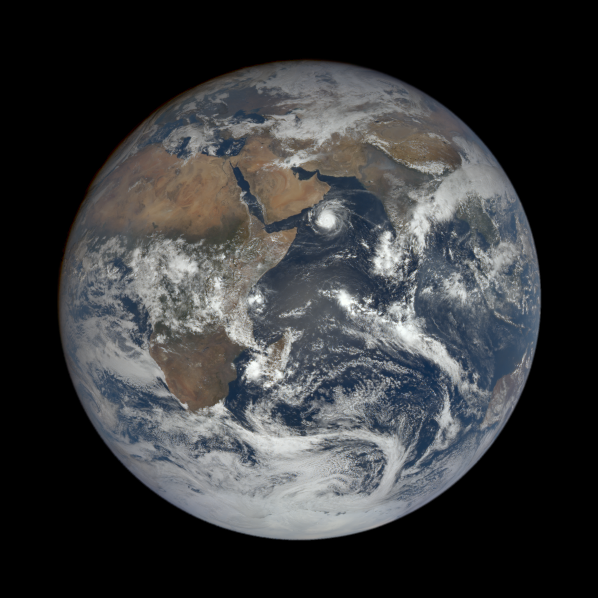
@nasas Disaster_map @noaa @stateofcalifornia FirEDATA Gula Matari Quincy Jones CD-ROM Software Library
